People’s Republic of China (中华人民共和国): West to East (Mar 29 to May 26, 2016)

china-map

After two months in Vietnam (see previous post), I went to China. While China had been on my list of places to visit, I didn’t want to go there alone. After reading several blogs and talking to fellow travelers who’d been there, I felt too overwhelmed to tackle such a challenging country alone, challenging only due to the language barrier and relative lack of English-speakers and foreign travelers outside of the big cities. While the prospect of visiting a less-traveled country sounded enticing, the idea of coping with travel logistics alone sounded daunting. Lucky for me, my friends Brett and Laura (UK), who’d I’d met and traveled with in Vietnam, invited me to join them to visit China. Now armed with travel buddies, I was ready to go.

Per Wikipedia, China is the world’s most populous country (1.38 billion people) comprised of 56 officially-recognized distinct ethnic groups, of which the Han Chinese are the largest group. While Mandarin is the most common language, there are as many as 292 living languages spoken in China. Most Chinese (~80%) practice some form of Chinese folk religion based on Taoism and Confucianism with fewer being Buddhist (10-16%), Christian (2-4%) and Muslim (1-2%).

With a land area of about 3.7 million sq mi (9.6 million sq km), China is similar in size to the U.S. However, China has the longest combined land border in the world (13,743 mi (22,117 km)) [compared to 7,515 mi in the U.S.] and borders 14 nations, more than any other country except Russia, which also borders 14. China is the world’s second-largest economy (just behind the U.S.) and the world’s largest exporter and second-largest importer of goods. China has the world’s largest standing army and second-largest defense budget (behind the U.S.), and is a member of the United Nations.

Once ruled by various dynasties, China is now one of the world’s few remaining socialist states openly endorsing communism, having been described as communist and socialist, but also as authoritarian and corporatist, with heavy restrictions, most notably against free access to the Internet, freedom of the press, freedom of assembly, the right to have children, free formation of social organizations, and freedom of religion.

China’s various landscapes are home to a high diversity of plants and animals and as such, China is designated as one of 17 “megadiverse” countries (countries, including the U.S. and Australia, that harbor the majority of Earth’s species and high numbers of endemic species). Unfortunately, a growing number of species are threatened by habitat destruction, pollution, and by use for traditional Chinese medicine. However, endangered wildlife is protected by Chinese law, and as of 2015, protected nature reserves covered about 18 percent of the country. It is also now illegal to eat an endangered species. While it appears that species and habitat are still inadequately protected overall, conservation efforts to protect some of China’s most charismatic megafauna and beautiful, unique landscapes are ongoing and will hopefully continue to increase.

So, what did I do for nearly 2 months in China, including one week in Hong Kong? First, while still in Vietnam, I downloaded a VPN (virtual private network) app on my phone and tablet so I could freely access the Internet and keep in touch via social media. Once in China, I explored quaint ancient towns, visited beautiful temples and historic sites, speed past mountainous terrain and lush green rice fields via train, volunteered at an English school, walked on the world’s longest wall, hung out with friends, and trekked, of course, among snow-capped mountains and China’s legendary karst formations.

Getting There

From the border town of Lao Cai, Vietnam, Brett, Laura and I walked across a short bridge into the small city of Hekou in the Yunnan Province, thus crossing the border into southwest China. After navigating the easy entry process, we stepped out of the immigration office and were suddenly in China and completely surrounded by the Chinese language. While beautiful to look at, the Chinese characters offered absolutely zero hint as to the meaning of the words written on the street signs, the storefronts, the restaurant menus, the bus stop signs, etc…. And unlike other borders I’d crossed, the three of us were the only foreigners around. It was exciting but a bit overwhelming and I was relieved to be with friends. None of us spoke or read Chinese but at least we could figure things out together. While no one around us spoke English, people were very friendly and with the help of translation apps, a map, and hand gestures, locals helped us figured out which bus to take to get to the train station and then which train to take to get to our first designation, Kunming, also in the Yunnan Province. During the 6-hour train ride, I was seated in a different row than my friends. Fortunately, after discovering I spoke English, a very sweet 50-something Chinese woman changed seats with her friend to sit next to me to chat. She was an engineer and spoke enough English to proudly tell me that her daughter graduated from Columbia and now worked in New York City. She also taught her ancient father, whom I was sitting next to, to say “Welcome to China, I love you” which made everyone around us crack up. We chatted, shared snacks, laughed a lot, and she wrote my name in Chinese. It was a very welcoming introduction to China.

Dali 大理市

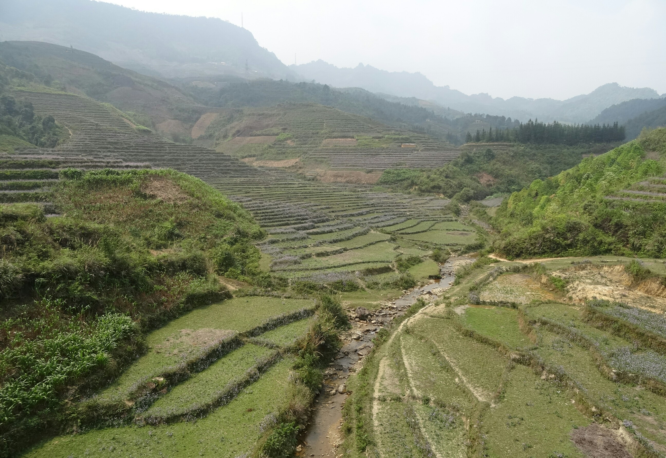
After a two-night stopover in Kunming to get our bearings, we took a 5-hour train to Dali still in the Yunnan Province. While a relatively large city (population 652,000), we went to Dali primarily to visit the old town, an ancient walled city whose buildings were constructed in traditional Chinese style, which per Wikipedia includes tiled roofs and bricks, plaster or whitewashed walls, and the use of talismans and imagery painted on doorways and walls to ward off evil and encourage the flow of good fortune. The city is nestled between tall snow-covered mountains and Erhai Lake. Roaming the streets inside the ancient walls was interesting but the highlight of exploring the area was riding rented bicycles through the small traditional villages and past the fertile fields surrounding the lake. I enjoyed riding down the narrow side streets admiring the curved tile roofs and decorative doorways. While the area was crowded with tourists (almost entirely domestic) it was beautiful and fun to explore.

Tiger Leaping Gorge 虎跳峡

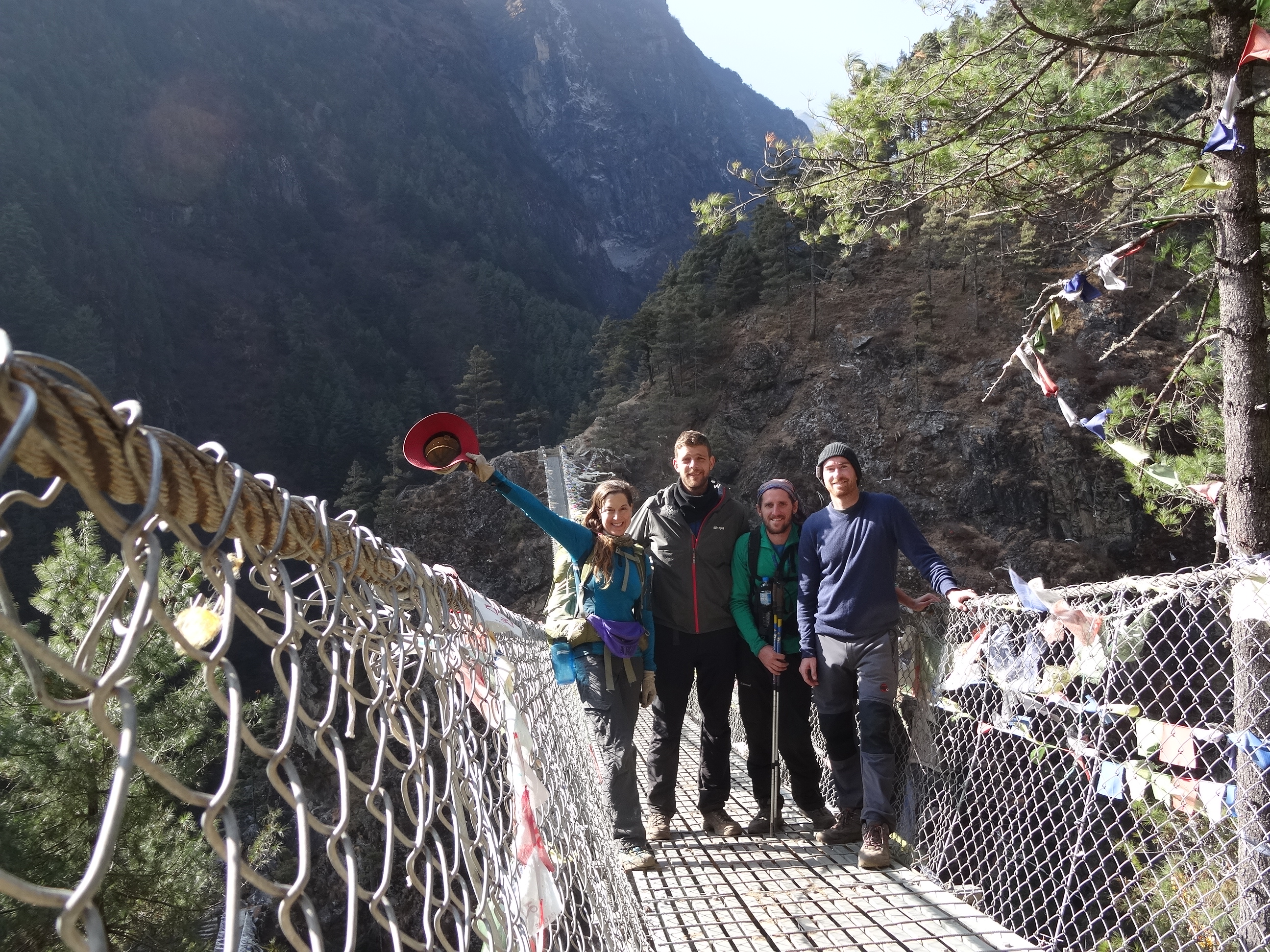
After a few nights in Dali, we took a 3-hour train to Lijiang (population 1.2 million), another popular tourist city in the Yunnan Province. While Lijiang is also known for its ancient walled city, a UNESCO World Heritage Site, I thought it was overrun with souvenir and ice cream shops and lacked the charm of Dali’s old town. Fortunately, we were there primarily to access Tiger Leaping Gorge, a scenic canyon on the Jinsha River, a primary tributary of the upper Yangtze River. After a few nights in Lijiang, we took a 1.5-hour bus with fellow trekkers to the trailhead and started the roughly 13-mi (20-km), 2-day Tiger Leaping Gorge trek. While we shared the trail with many trekkers (mostly domestic), the steady stream of people thinned out considerably after the first few miles, allowing for a lovely, relaxing hike. The trail is situated high on the northern side of the gorge passing through quiet villages, terraced farmland, and pine forest all within view of Jade Dragon and Haba mountains. For much of first half of the trek, the view was obscured by tall, dense stands of bamboo. Thankfully, the view finally opened up, revealing the narrow, raging river thundering through the deep canyon below. While not the deepest canyon I’ve looked down into, sections of the deep gorge were spectacular and having a beer with Brett and Laura at our hostel’s rooftop deck overlooking the gorge after a day of trekking was fantastic.

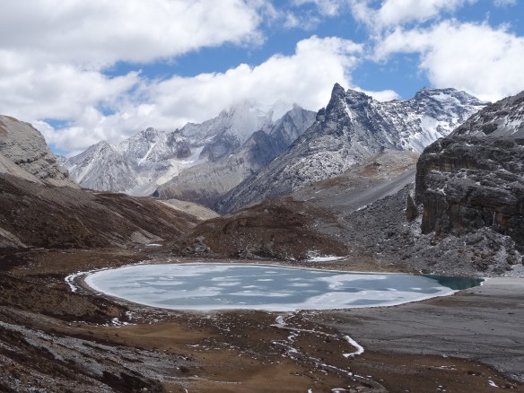
Yading Nature Reserve ཉིང་རྟེན

From Tiger Leaping Gorge, the three of us headed further north to hike the mountains in the Yading Nature Reserve in the Sichuan Province. To get there, we first took a 3-hour bus to Shangri-la (population 130,000). Per Wikipedia, the city was renamed as Shangri-la in 2001 after the fictional land of Shangri-la in James Hilton’s 1933 novel, Lost Horizon, in an effort to promote tourism in the area. It was a large, modern city with an old town that was touristy but charming, and home to the beautifully ornate Songzanlin Monastery and the Gold Temple. In the evening we watched a large group of locals do their nightly dance in the central plaza. Group dancing is practiced commonly throughout China (and other parts of Asia) as a form of exercise and community bonding. It was cool to see people of all ages dancing together and enjoying the evening. After two nights in Shangri-la, we took a 5-hour bus packed with locals to Xiancheng then a 2-hour minivan to Daocheng. The 5-hour bus ride felt much longer than it was; the seats were made for tiny people, the only ventilation was via open windows, and there was no bathroom on the bus. I prefer fresh air to AC but it was cold outside, so when the windows were closed against the cold, it got very hot and humid in the bus. Then when the windows were opened for the smokers, it got very cold and smoky. The majority of our fellow passengers were men, most of whom smoked frequently. So, we and the other non-smokers were subjected to alternating periods of hot, humid air and icy cold, smoky air. As for the bathroom situation, I’d been on many buses without bathrooms. However, the bus would typically stop at a bathroom every few hours. Our bus, however, stopped at one bathroom that was absolutely disgusting and otherwise stopped a few times on the side of the road, once near some abandoned buildings. The men went in one direction but not far from the bus while us ladies went in search of some privacy. Fortunately women tend to bond together regardless of nationality, age, etc…so us ladies helped provided some privacy for each other. Most of the bus rides were fine but a few were adventures. (Note to self:  wear a skirt when traveling on buses without bathrooms.)

Once in Daocheng, we reunited with Charlie and Nell (UK) who we’d met in our hostel in Lijiang. Daocheng is a small town (population 30,000) fairly close to the Tibetan border. After bundling up against the cold, the five of us explored the town a bit, having a delicious dinner of local dishes including spicy goat cheese soup, which was a treat since cheese is not commonly eaten in China. The next day, we took a 2-hour minivan to Yading Nature Reserve. The road took us along tall mountains overlooking deep valleys and across barren wind-swept plateaus whose peaks were dotted with Buddhist stupas and prayer flags. There’d been no other foreigners on our bus or on the minivans to get to Yading and none at our hotel, but with the help of a translation app and a Chinese tourist who spoke a little English, the five of us got checked into our rooms then bundled up to explore the Reserve for a few hours before dark. It was cold and a little rainy but the views were amazing. After dinner, we huddled around the communal stove in the hotel lobby reminiscing about the trip to get to this remote reserve. It’d been a long journey but it was already apparent that it was well worth it.

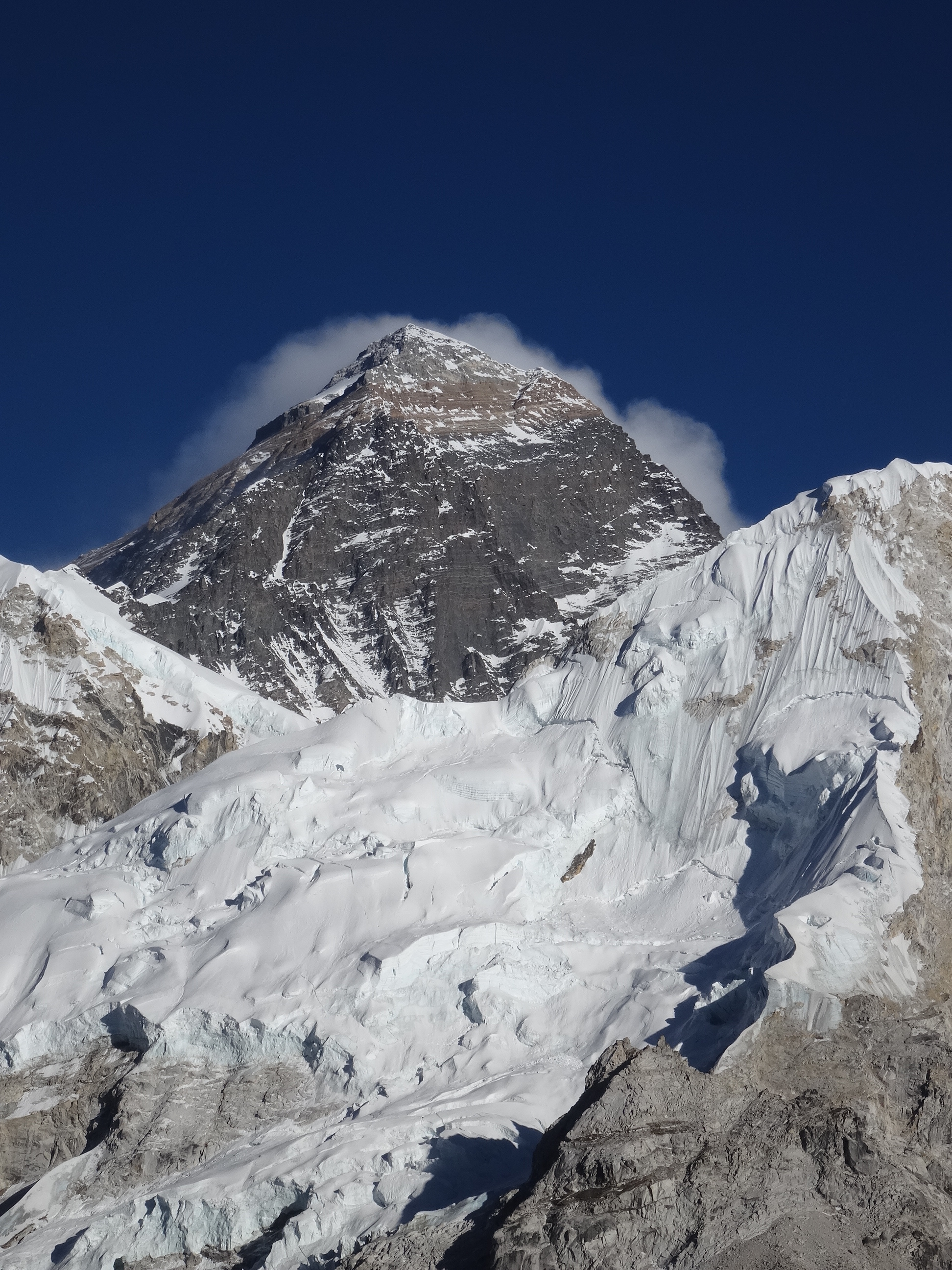
Per Landofsnow.com, the 520-sq mi (1344-sq km) Yading Nature Reserve was first introduced to the world when the famous American botanist and adventurer Joseph F. Rock published an article and photographs in National Geographic in 1928, saying “Where in all the world is to be found scenery comparable to that which awaits the explorer and photographer!” The area is most known for its three holy mountains, Chenrezig, Jambeyang, and Chanadorje which are worshipped as embodiments of the three Bodhisattvas of Mercy, Wisdom, and Power, respectively. Local Tibetans believe that the three holy mountains protect them and try to complete a circuit around Chenresig at least once a year.

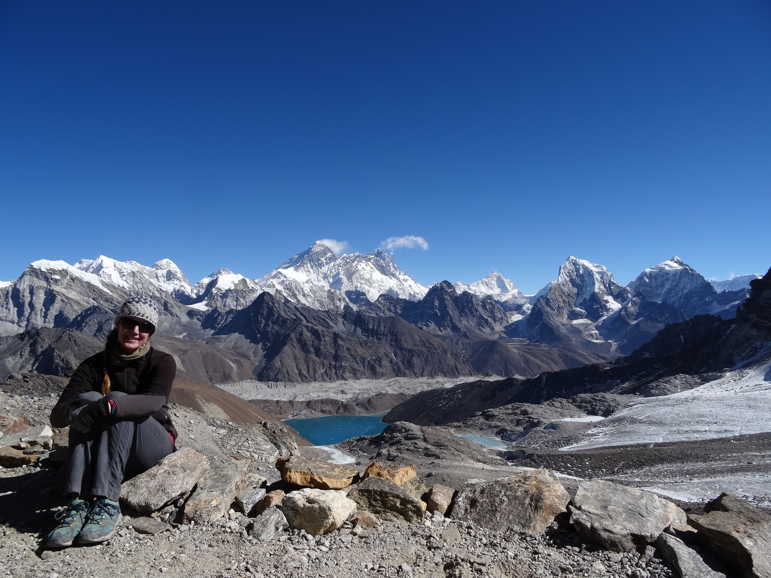
Thankfully by the time I woke up at 6am in next morning, it had stopped raining and the skies were mostly clear. Since Yading has an average elevation of well over 13,000 ft (4000 m), it was still darn cold. My friends opted to explore the Reserve at a more reasonable hour, so I spent the day trekking solo. I’d decided to try to complete the “small kora, a popular Tibetan Buddhist pilgrimage circuit around Chenresig (19,790 ft (6032 m)), the highest mountain in the Reserve. By about 8am, the electric carts shuttling people to various parts of the Reserve started operating so my solitude was broken by dozens of fellow visitors, all domestic. However, after trekking several miles further, I left the majority of the crowd behind and had the trail almost entirely to myself for the rest of the day. The trail went through a huge lush meadow, then climbed up and over two barren, windswept passes, the highest at 15,419 ft (4700 m), where colorful prayer flags flapped in the wind, then lead back down through another deep valley. It was amazing to be surrounded by tall, jagged, snow-covered mountains, watching the winds swirl the clouds around their peaks. It was absolutely stunning.   

While hiking up to the final pass, I caught up to a local family also on their way up to the pass, perhaps on a day-long pilgrimage. They were three young adults and a woman who appeared to be their grandmother. I hadn’t seen them on my trail before so assumed they’d come up another trail. I don’t know how far their hike had been to get to that point, but any trail to the pass would be steep and rugged and grandma was trudging up at a steady pace. As I passed the family, the grandmother gently grabbed my arm, flashed me a huge toothless smile, and gave me a thumbs up. She also said something that I unfortunately couldn’t understand but from her smile and gestures, I felt that she was telling me “good job solo female trekker exploring in a foreign land.” And in return, I gave her a huge toothy smile and a thumbs up which I hoped she understood as “awesome job elderly female trekker who’s likely done this trek a million times.” It was another inspirational moment on a mountain. By the end of the 10-hour, 19-mi (32-km) hike, I was exhausted but super happy, and I agreed with Mr. Rock who referred to this land of snow-capped mountains, steep cliffs, crystal clear lakes, vast pastures, and dense woods was a “harmonious utopia.”

Chengdu 成都市

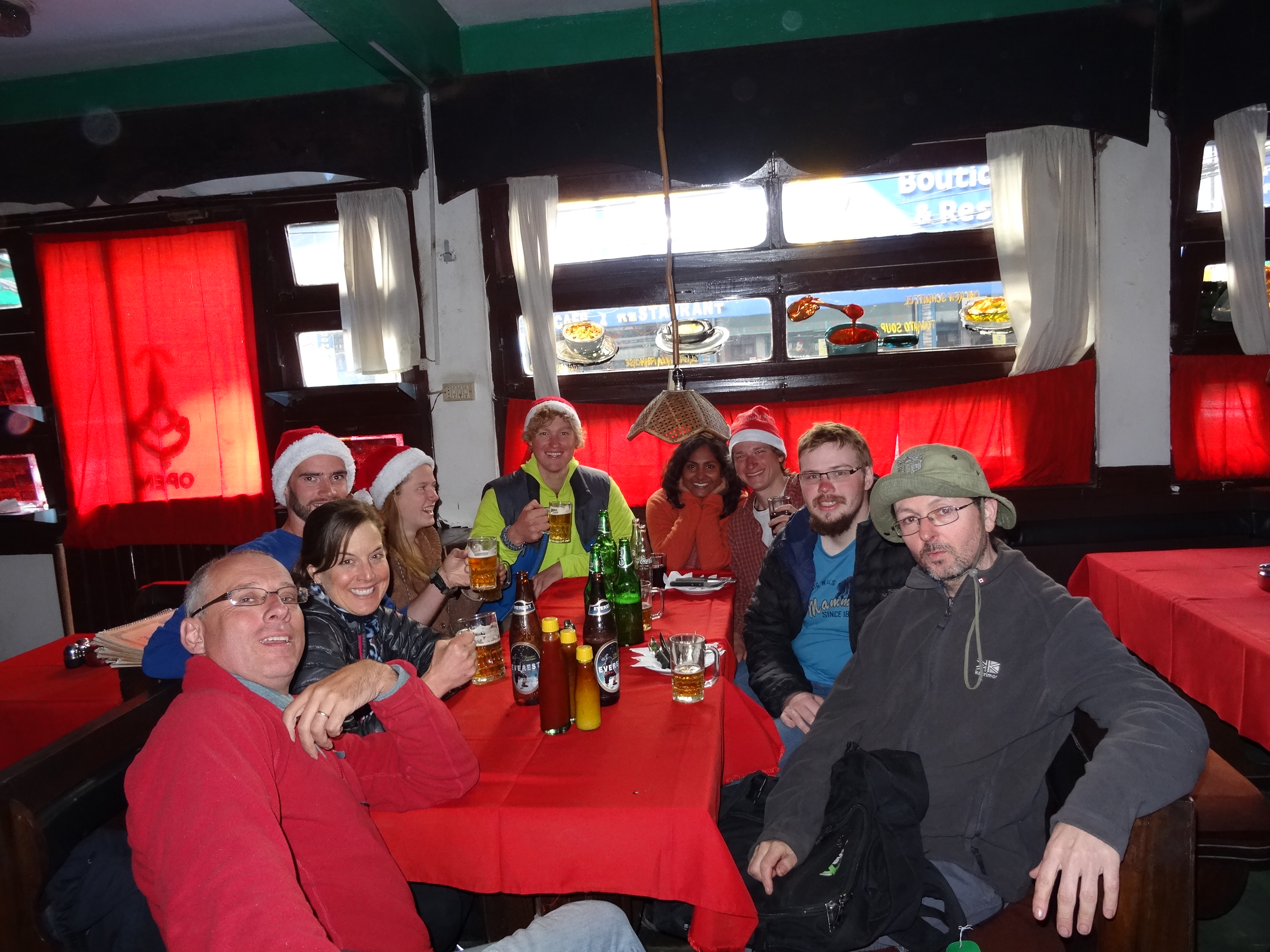
From Yading, our 5-person crew returned to Daocheng for a night then took a 20-hour bus east to Chengdu, the capital of the Sichuan Province. The bus was also crowded (all locals), had uncomfortable seats, and stopped at disgusting bathrooms but at least smoking was prohibited onboard! Chendu. While there, we warmed up (now off the Tibetan plateau), relaxed, and had fun roaming the streets of this large, modern city (population 10+ million). We were there primarily to visit the Chengdu Research Base of Giant Panda Breeding, a conservation center where visitors can view endangered giant pandas and their distant cousins, red pandas, in a semi natural habitat. Unfortunately due to habitat destruction, giant pandas only live in scattered populations in the mountains of central China, mostly in Sichuan Province, but also in Gansu and Shaanxi Provinces. A recent census found only about 1,864 giant pandas in the wild. However, their numbers are increasing due to increasing forest protection and reforestation (http://www.iucnredlist.org). After a day of oohing and aahing at cute pandas, we had a few beers at our hostel then, along with our new friend, Vivian (China) who we’d met at our hostel, had a night out on the town. As some of the few foreigners at the dance club, we were befriended quickly by a table of local partygoers who insisted on supplying us with drinks all night long. It was a fun night of drinking and dancing.  

Xi’an 西安

After five nights in Chengdu, we said farewell to Nell and Charlie, and Brett, Laura, and I took an 8-hour train northeast to Xi’an in central China’s Shaanxi Province. Xi’an is a large, modern city (population 8+ million) well known for its walled old town, for being the starting point of the Silk Road, and for the famous Terracotta Army. Per Wikipedia, the Terracotta Army is a collection of terracotta sculptures depicting the armies of Qin Shi Huang, the first Emperor of China, discovered in 1974 by local farmers. It is a form of funerary art buried with the emperor in 210–209 BC and whose purpose was to protect the emperor in his afterlife. The figures vary in height according to their roles, with the tallest being the generals. Per estimates in 2007, the three pits containing the Army held more than 8,000 soldiers, 130 chariots with 520 horses and 150 cavalry horses, the majority of which remained buried in the pits nearby Qin Shi Huang’s mausoleum. Other terracotta non-military figures were found in other pits, including officials, acrobats, strongmen and musicians.

We spent a full day exploring the three pits containing the unearthed and partially unearthed figures. I have to admit I was sceptical that the exhibit wouldn’t live up to the hype, but I was pleasantly surprised. In fact, it was amazing to see the figures up close, each face and uniform slightly different from the next. And it was cool to watch as archaeologists continued excavating portions of the largest pit. The craftsmanship of the figures and their numbers was truly amazing.

Another highlight of Xi’an was visiting it’s Muslim Quarter which covers several blocks and, per Wikipedia, is inhabited by over 20,000 Muslims. Walking the narrow streets crowded with locals and tourists was a feast for the eyes and the taste buds. While exploring we sampled some sweet and some savory treats then had mutton stew for dinner, apparently a very distinctive dish of Xi’an. Given the muslim influence, the food was different in content and flavor than the noodle soups and rice dishes we’d tried so far, making it extra tasty.      

Zhangjiajie National Forest Park 湖南张家界国家森林公园

After two nights in Xi’an, we took a 16-hour train south to Zhangjiajie City in the Hunan Province, the gateway to Zhangjiajie National Forest Park, China’s first national forest park. Per Wikipedia, the park, established in 1982, has an area of 11,900 ac (4,810 ha) and lies within the much larger Wulingyuan Scenic Area, a UNESCO World Heritage Site and Global Geopark. The most notable geographic features of the park are the pillar-like formations seen throughout. Although resembling limestone karst terrain, this area is not underlain by limestone, instead these formations are the result of many years of weathering due to expanding ice in the winter and plants growing in the cracks. Due to the moist weather year round, the foliage in the park is very dense. These formations are a distinct hallmark of Chinese landscape and can be found in many ancient Chinese paintings.

Apparently, these formations from around China, including from Zhangjiajie, inspired the floating Hallelujah Mountains seen in the film Avatar. Hence the reference to the park among us foreigners as the Avatar park (along with our difficulty pronouncing Zhangjiajie). Armed with my multi day entry ticket, I explored the park daily for three days, walking up and down thousands (literally) of steep stone steps and along miles of stone walkways to view the spectacular scenery.

The park was very crowded, mostly with domestic visitors, and the visitor areas were super touristy with souvenir shops, food stalls and eateries (including McDonald’s), and paid photographers temping you and your family to dress up in traditional costumes in front of amazing vistas. It was like being at Disneyland in the mountains or Yellowstone National Park in the summer. Fortunately, the park is only accessible by a shuttle bus so it’s not congested with cars, just fellow explorers. Despite the heavy congestion of people at the most popular and easily accessible viewpoints, it was fairly easy to escape the crowds by walking further from the trailhead and by getting around the park via the many stairways versus the aerial trams. I think I climbed five hundred thousand stairs over my 3 days of hiking around the park! OK, that may be an exaggeration, but only a slight one. However, the climb up through the lush forest along small streams and waterfalls was gorgeous and mostly peaceful, and at the top I was rewarded with views overlooking vast fields of tall, pillar formations of various sizes that appeared to be floating above the clouds, just like in the movie.    
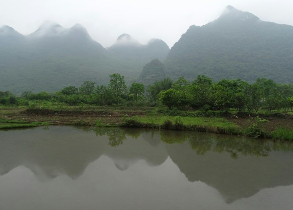
Yangshuo 阳朔县

After exploring the Avatar park, we took an overnight train further south to Guilin then took a short bus ride to Yangshuo (population 300,000) in southern China’s Guangxi Province. We spent a day on rented bicycles riding past Yanshuo’s famous dramatic karst peaks along the Li River path and in the evening explored the town. Yangshuo is very touristy and due to its popularity among foreign tourists, many locals speak English. However, it was quite charming and the surrounding landscape was beautiful. After two nights there, I said farewell to Brett and Laura. They’d decided to go to Hong Kong and I’d decided to stay in Yangshuo for a bit longer. It was strange to think about being solo again after traveling with them in Vietnam and China for the past 2 months!

 I’d wanted to stay in Yangshuo to volunteer at the Zhuo Yue English College that my friend Jose (Nicaragua), who’d I’d met in Vietnam, told me about. In exchange for a bed in the 4-bed dorm room and 2 meals per day, I would help students practice their English for 2 hours each evening and during meals in the cafeteria. The students ranged in age from 17 to 35 and were from all around China. They lived at the college and attended classes all day, four days week. The students I met spoke English at various levels. For the nightly sessions, the college staff provided discussion topics to help lead the conversation. The topic my first night was responsibility (i.e., what are your responsibilities to your family, your neighbors, to society?). We talked about individuals’ responsibilities in China compared to in the U.S. I’d thought that in Chinese culture, young families traditionally housed their aging parents to take care of them but learned from the students that this is true mostly in rural areas where houses tend to be larger but that in cities, where space is limited and expensive, parents who need assistance often live in assisted living homes paid for by their children resulting in added financial stress for the young family. We agreed that most of us have become detached from our neighbors and community, and blamed our general reluctance to put down our smartphones. On the lighter side, we talked about our favorite music (hip hop, of course!) and talked about our favorite TV shows (everyone loves Game of Thrones!). Needless to say, the evening sessions were interesting and fun. During the evening sessions, at mealtimes, and during a few games of ma jiang (a traditional Chinese dominos-like game), I learned about my new friends Allen, Jack, Alisa, Vinny, Mary, and others, about their lives, culture, and beliefs, and they learned about mine. We had fun and laughed a lot together. It was an excellent experience.

Hong Kong 香港

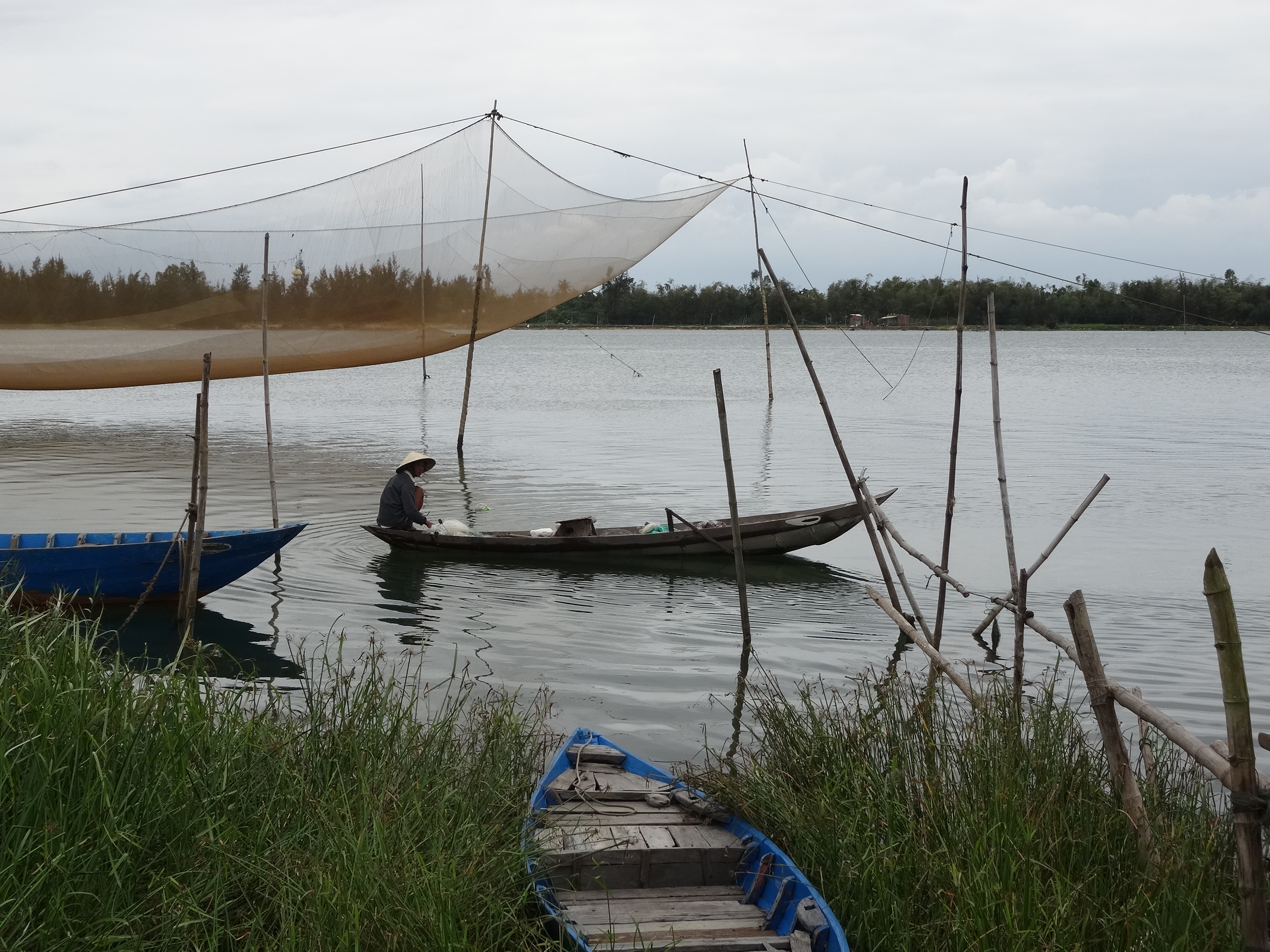
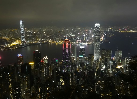
After 8 days in Yangshuo, I took an overnight bus south to Shenzhen then the local subway across the border to Hong Kong, officially the Hong Kong Special Administrative Region, an autonomous territory of China. Per Wikipedia, Hong Kong is a small island (427 sq mi (1,106 sq km)) with a population of over 7.3 million people of various nationalities, ranking as the world’s fourth most densely populated sovereign state or territory. Many of my fellow travelers recommended visiting Hong Kong, saying it was a very clean, modern city where most of the locals spoke English and you could find familiar foods, most notably a good burger. (After weeks of noodle soups and rice dishes, food discussions often centered around the desire to have a good burger.) Even with those reviews, I had only a half-hearted desire to visit the big, modern city, especially after hiking in the splendor of the Avatar park and hanging out in quaint Yangshuo. Lucky for me, I’d arranged via Couchsurfing to stay with Alan, a Hong Kong native who was happy to host travelers at his home on Langtau, Hong Kong’s largest island. He was a wealth of information and hearing that I liked to hike, told me about the numerous hiking trails all over Hong Kong. It turns out that since most of Hong Kong is hilly and mountainous, the majority of the country, about 70%, is maintained as green space, of which about 40% is protected park land. So along with going to Victoria Peak to view the city’s famous night time skyline and exploring the crowded, fluorescent-lite market streets selling anything imaginable, I hiked along the coast, going through small fishing villages, and hiked the Dragon’s Back Trek along the ridges overlooking the islands of Hong Kong. I enjoyed Hong Kong so much, especially the more peaceful Langtau Island, that I ended up staying there for 5 days!

Hangzhou 杭州市

From Hong Kong, I took an overnight train northeast to Hangzhou (population 9 million), the capital and most populous city of Zhejiang Province (about 109 mi, 177 km from Shanghai). I went to Hangzhou primarily to visit my friend Carla, who I’d met and traveled with for a few days in Vietnam. It was funny to be in China staying with Carla, who’s from Spain, and her roommates, Alba, also from Spain, and Tal from Israel, all of whom were attending Zhejiang University and learning Mandarin. Apparently many international students attend the university, which per Wikipedia, is one of China’s most prestigious. While my friends were in class, I relaxed in their apartment and explored the city and Hangzhou’s famous green tea fields. Carla also showed me around the city, taking me to a few of her favorite markets and restaurants. On a Friday night, the girls took me to a friend’s birthday party, where I met their friends who were from various countries including Italy, Spain, Mexico, and Russia, living in Hangzhou for work or to attend the university. I was in heaven drinking red wine sangria and munching on bruschetta with pesto. Later that night, we went dancing at a club frequently by locals, many of whom were African. I was surprised to see so many Africans in China. Per Wikipedia, once it officially became a Communist nation in 1949, China, like the Soviet Union and other Communist nations, recruited Africans to study in its universities in a bid to gain support among the emerging generation of third world political leaders. As a result of the large scholarships and substantial financial support, there was a huge influx of African students. By 2014 an estimated 500,000 Africans, Afro-Caribbeans, and African Americans were present in China, there to engage in the lucrative import and export business or as students or tourist, many of whom have settled in the port city of Guangzhou and Hangzhou. It was great to be in such an international city.

Mount Huangshan Scenic Area 黄山

After five nights in Hangzhou, I took a 4-hour bus southwest to Tangkou in Anhui Province, the gateway city to Mount Huangshan Scenic Area, a UNESCO World Heritage Site. Per Wikipedia, Mount Huangshan is a granite massif consisting of 36 separate peaks, rising above 6,000 ft (1,828 m). The area is well known for its scenery, sunsets, peculiarly-shaped granite peaks, Huangshan pine trees, hot springs, winter snow, and views of clouds touching the mountainsides for more than 200 days out of the year. Famous throughout Chinese artistic history, Huangshan represents the typical mountain in Chinese paintings.  

I spent a day exploring this beautiful park, which similar to Zhangjiajie National Forest Park, meant climbing up and down thousands (literally) of steep stone steps, many of which were carved into the mountainside. The park was very crowded, mostly with domestic visitors, but with fewer souvenir shops. Thankfully, it was again fairly easy to escape the crowds by walking further away from the easily accessible sites and by using the stairs instead of the trams to get around. And while the topography of the park was similar to that of the Avatar park, the views overlooking vast fields of tall, granite formations were stunning.

Suzhou 苏州市

After returning to Hangzhou for a night, I took a 3-hour train northeast to Suzhou in Jiangsu Province, about 62 mi (100 km) from Shanghai. It’s a large city (5.5 million) known for its canals, bridges, and gardens. Through Couchsurfing, I’d met and stayed with Alessandra (UK) who’d been living there for about 9 months teaching English. She was a wealth of information about the city and was great to hang out with. She took me out to try some local foods, including a soup she referred to as “savory soya soup” that was interesting, and slimy glutinous rice balls with black sesame or red bean paste filling that was delicious. She also took me to a great local market with beautiful produce and interesting food items for sale. While there, I bought six hard boiled eggs. I’d been buying hard boiled eggs, called tea eggs, regularly from all over China (and Vietnam) but these held a surprise. After taking a bite, I looked down at the partially eaten egg and noticed a very tiny claw sticking out of the other half the yolk. Oh damn! Tea eggs are made from unfertilized and fertilized eggs but up until then, I’d been lucky in buying only the unfertilized ones. I’m not judging anyone who likes eating fertilized eggs but I couldn’t do it. Perhaps I should have known given that these eggs were slightly more expensive than usual; more protein I guess. Ha! During my 4-day stay in Suzhou, I also walked around the city, particularly along its famous canals which were particularly beautiful at night with the city lights shining.

Beijing 北京市 & The Great Wall of China 长城

From Suzhou, I took a high-speed train, my first in China, northwest to Beijing (population 21 million). Traveling at a top speed of 192 mi/hr (309 km/hr), the roughly 728 mi (1172 km) journey took less than 6 hours. Wow!! Per Wikipedia, Beijing, the nation’s political, cultural, and educational center, is the second largest Chinese city after Shanghai and the world’s third most populous city. Beijing also has one of the longest and busiest subway systems in the world.

The day I arrived in Beijing, I reunited with Brett and Laura, who’d been there for several days already. It was great to see my travel partners again! During my 11 day stay in Beijing, I was fortunate to stay with new friends I’d met via Couch Surfing, staying with Gabriel (China) at his apartment in north Beijing for four nights then with Sujin (South Korea) in her apartment in northeast Beijing for six nights. It was great to talk to them and get the different perspectives from a native and a nonnative who’d been living in Beijing for several years. It was also interesting to stay at their apartments in the north and northeast residential areas of Beijing versus staying in super touristy central Beijing. Thankfully since Beijing’s subway system is extensive and signs are also in English, it was easy to get to all parts of the huge city.

While in Beijing, I visited some of the main tourist sites like the Summer Palace, China Natural Museum, Tiananmen Square, Jingshan Park overlooking the Forbidden City, all interesting places but, as you can imagine, packed with people. I also went to the Panjiayuan Flea Market, Beijing’s biggest and best-known arts, crafts, and antiques market. Brett, Laura and I had a fun day walking up and down the endless aisles of interesting items ranging from pottery, masks, dishware, vases, furniture, jewelry (gold, silver, jade), prayer beads, etc… While in Beijing, I also reunited with Vivian (China), who’d I’d met and gone dancing with in Chengdu. I spent an evening with her and her friend, Michelle (China), both of whom lived in Beijing, chatting away as they showed me around the popular Shichahai Lake area. On another night, the three of us girls and Sujin, had a night on the town. I felt very underdressed at the up-scale, LA-style dance club they took me to but the music was kicking and we had a super fun night shaking our grove thangs.      

I also visited some great food streets and hutongs per Gabriel and Sujin’s suggestions. The food streets were packed with tourists, mostly domestic, who, like me, came to see and maybe taste some of the strange foods (i.e., starfish, scorpion, seahorse, etc…on a stick) offered by the street vendors. I walked up and down the blocks several times to get second and sometimes third looks at the food offerings, mostly to try to figure out what the foods where. Animal, vegetable, mineral? I didn’t end up trying any of the strange goods but mostly because the lines for the items I thought I could stomach were too long. It was a fun and interesting experience.

The few hutongs I strolled through were much more peaceful. Per Wikipedia, hutongs are ancient neighborhoods, some several hundred years old, with narrow streets or alleys commonly found in northern China, particularly in Beijing. Following the founding of the People’s Republic of China in 1949, many of the old hutongs of Beijing were replaced by wide boulevards and high rises. However, many of Beijing’s ancient hutongs still stand, and a number of them have been designated protected areas, offering a glimpse of life in the capital city as it has been for generations. It was great to walk down the quiet, narrow streets and alleys, passing local residents going about their day.      

While I explored some of the sights of the city, I spent much of my time in Beijing relaxing. After moving all over China for almost two months, I was happy to stay “home” for a few days, write in my journal, catch up on my favorite TV shows via the Internet, and relax. Thankfully, Gabriel and Sujin, being travelers themselves, understood and didn’t mind me chilling at their cozy apartments while they were at work.

Two days before my flight out of China, I finally visited the Great Wall of China. Of course I was not going to leave Beijing without seeing at least a section of this historic site. Per Wikipedia, the Great Wall is a series of fortifications made of stone, brick, and other materials generally built along an east-to-west line across the historical northern borders of China. The Wall also includes watch towers, troop barracks, garrison stations, and signaling capabilities through the means of smoke or fire. Along with providing protection against raids and invasions of various nomadic groups and control of immigration and emigration, the Wall also allowed taxation of goods transported along the Silk Road. While several sections were built as early as the 7th century BC, the majority of the existing Wall is from the Ming Dynasty (1368–1644). The Ming walls (including the actual wall, trenches, and natural defensive barriers like hills and rivers) measure 5,500 mi (8,850 km) while the entire wall with all of its branches measures 13,171 mi (21,196 km). Wow!

Brett, Laura, and I took a 1.5-hour bus to the Mutianyu section of the Great Wall. This is one of the closest and most accessible sections from Beijing which would typically make it one of the most crowded sections. However, since we opted to visit the Wall on a day forecasted for rain, we were pleasantly surprised by the relatively low numbers of fellow tourists. After walking past the gondola and instead ascending the 4,000+ steps (no, really!), we stood on top of the Wall where we overlooked miles of lush, green forest. At this section, the Wall is primarily granite and is roughly 26 ft (8 m) high and roughly 16 ft (5 m) wide (per Wikipedia). Much of this section has been restored but continuing along the Wall and up and down hundreds of more steps, we were able to visit unrestored sections as well. It was really cool to see the difference between the restored and the crumbling unrestored sections. It was only by standing on the Wall and looking out at its meandering path up and down the forested hills and valleys that I finally got a sense of its massive scale. It’s amazing to think that anyone could have penetrated such a structure.

On my last night in China, I met Brett and Laura for our last dinner together. We were joined by Victoria and Brett, an American couple we’d met on the bus from the Wall back to Beijing. After peaking through restaurant windows for a bit to try to gauge the quality of the food, we finally settled on a place that looked good. Since crossing the border into China almost 2 months earlier, Brett had been talking about eating Peking Duck and I’d totally gotten on board with giving it a try. Per Wikipedia, Peking Duck is a famous duck dish from Beijing that has been prepared since the imperial era. Once slaughtered, the whole duck is seasoned then roasted in a closed or hung oven. The meat is prized for its thin, crisp skin, with authentic versions of the dish serving mostly the skin and little meat, sliced in front of the diners by the cook. The meat is eaten with scallion, cucumber, and sweet bean sauce with pancakes rolled around the fillings.

The duck was served to us in four ways: a plate of sliced meat with the skin, a plate of meat without skin, a plate of deep fried bones, and a bowl of duck soup. I’m not a big fan of duck meat but the meat was tender and delicious and eating it Peking-style in a pancake with the traditional filling was a must. Having a delicious traditional meal with friends was a fantastic way to end my visit.   

My experience in China was educational, interesting, and fun. Overall, I found the Chinese people I encountered to be friendly and helpful. It’s amazing how a smile can make strangers into friends. Many people were also very inquizitive, openly staring at me and my friends, and grabbing us enthusiastically to take pictures with them. I felt like a celebrity (or an alien), which was at times annoying but mostly funny. (I wonder how many pictures of me with strangers are posted on Facebook?) I was also blown away by China’s beauty, from the snow-covered mountains, tall karst and rock formations and deep river gorges to the lush rice terraces. China truly has some unique and mystical landscapes. My experience was made even more memorable by the wonderful people, Chinese and fellow travelers, with whom I shared it. I’m especially thankful to my good friends, Brett and Laura, with whom I shared many wonderful adventures with during our time traveling together. I hope we can explore some other parts of the world together in the future.

Here are a few pictures. Click the link to see the full album:  https://goo.gl/photos/Gh6FFX65jQg62335A

Enjoy!

2016-03-29-17-47-36

2016-04-01-09-03-56
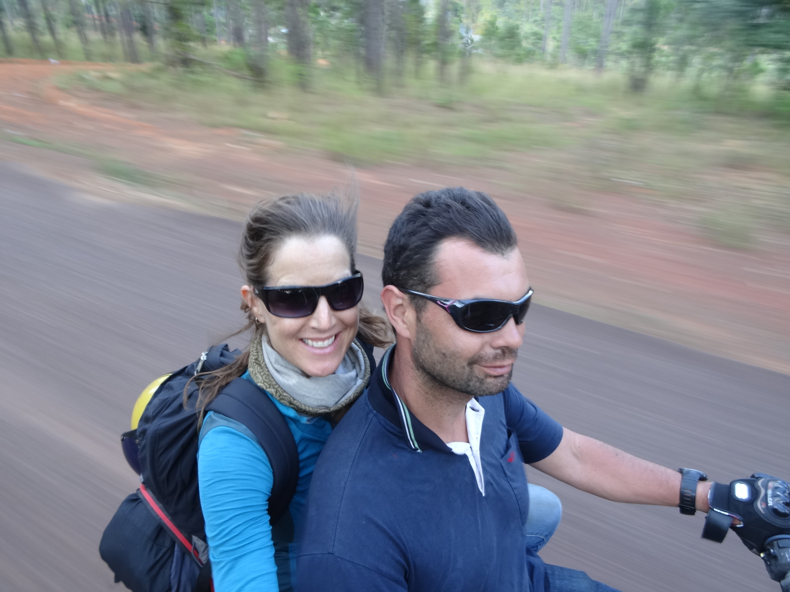
About to ride around the lake with Laura & Brett in Dali.
2016-04-05-10-04-48
Tiger Leaping Gorge
2016-04-06-17-41-03
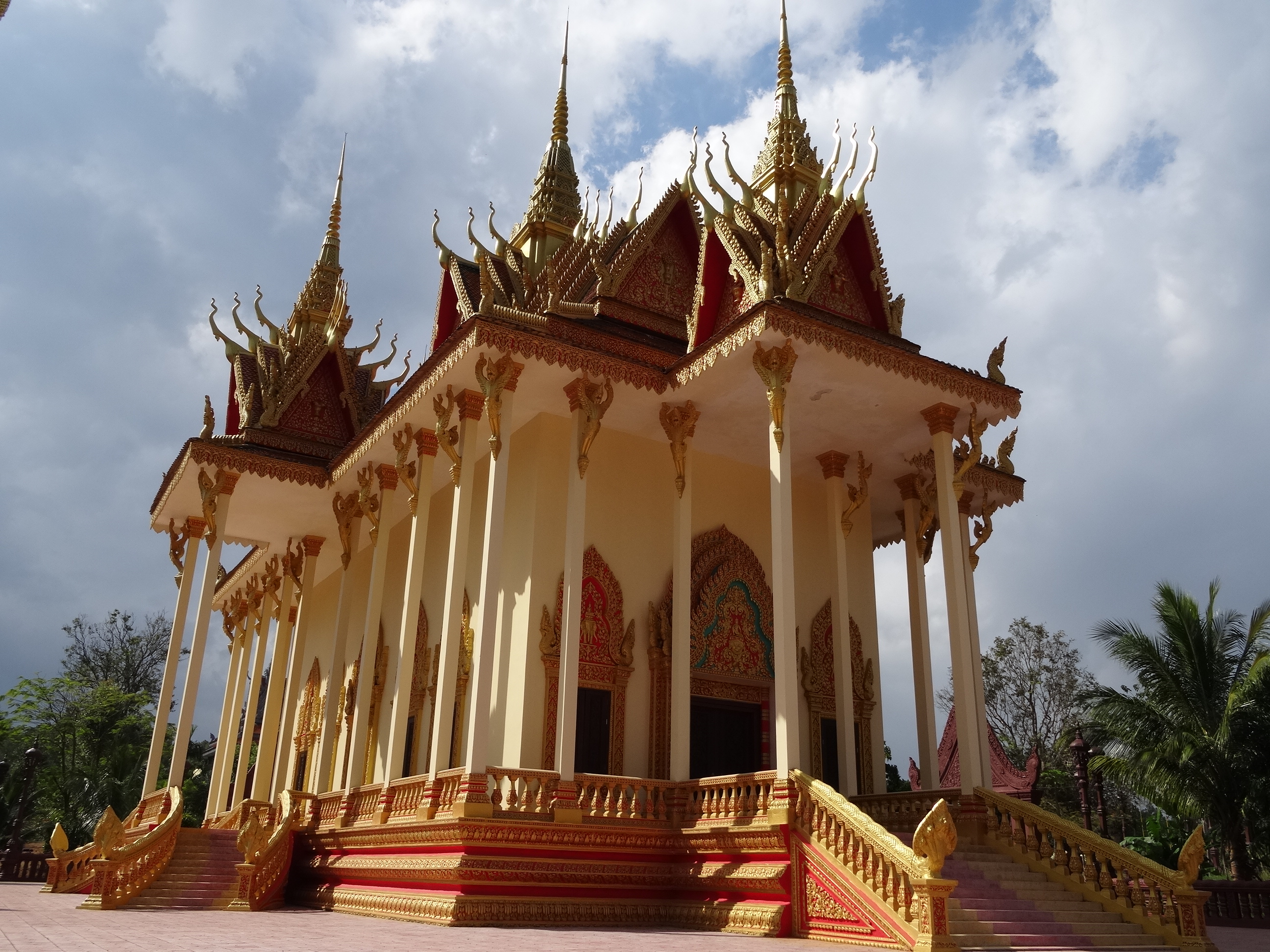
Gold Temple, Shangri-la.
2016-04-09-09-49-35
Yading Nature Reserve.
2016-04-14-08-47-41
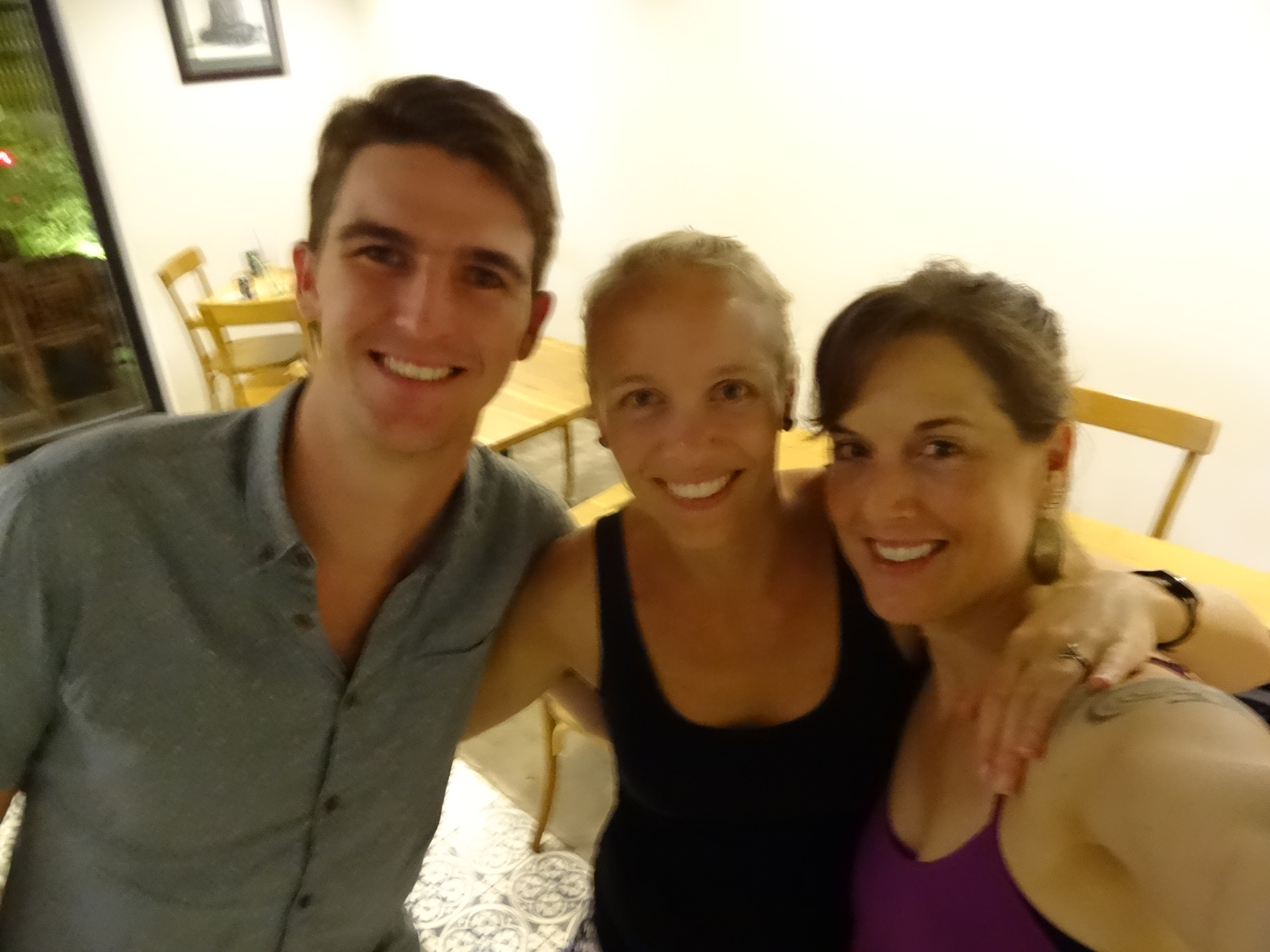
With Charlie, Nell, Laura, and Brett in Chengdu.
2016-04-18-13-59-37
Terracotta Army, Xian.
2016-04-22-16-00-31
Zhangjiajie National Forest Park.
2016-04-25-13-10-13
Yangshuo
2016-04-29-18-14-06
With friends from Zhuo Yue English College, Yangshuo.
2016-05-04-21-08-53
Hong Kong skyline.
2016-05-04-09-58-18
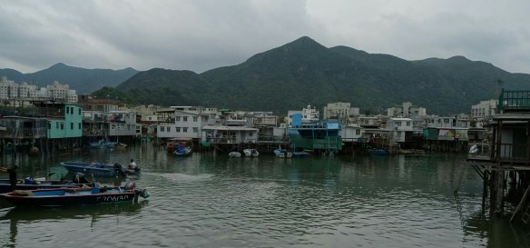
Fishing village, Hong Kong.
2016-05-12 21.50.09.jpg
With Carla, Alba, Tal and friends in Hangzhou.
2016-05-11-11-31-54
Huangshan National Park.
2016-05-15-12-20-44-1
Suzhou.
2016-05-20-22-38-31
With Sujin, Michelle, and Vivian in Beijing.
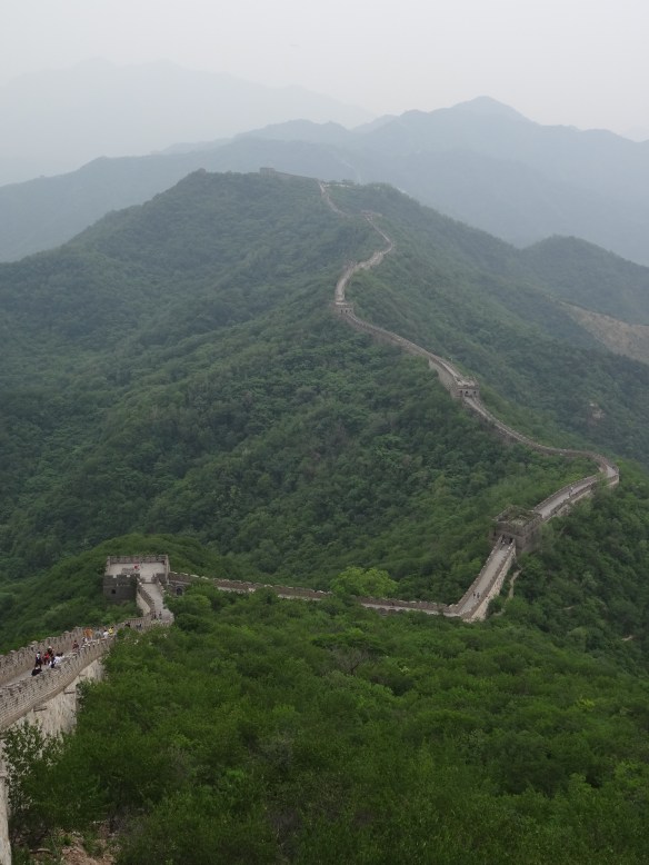
2016-05-23-13-07-00
The Great Wall.
2016-05-23-13-57-04
With Laura and Brett at an unrestored section of the Great Wall.

Vietnam: Ho Chi Minh City to Hanoi and Beyond (Jan 28 to Mar 28, 2016)

After one month in Cambodia (see previous post), I took a 7-hour bus from Phnom Penh to Ho Chi Minh City, Vietnam. Per Wikipedia, the Socialist Republic of Vietnam has historically been a relatively poor country with an economy based on agriculture, predominantly rice. However, about a decade following the reunification of north and south Vietnam and end of the Vietnam War in 1975, the country underwent significant economic and political reforms. As a result, Vietnam’s economic growth rate has been among the highest in the world since 2000. Along with rice production, manufacturing, high-tech industries, and oil production now form a large and fast-growing part of its economy. The country is currently the 8th largest crude petroleum producer in the Asia and Pacific region. And with this economic growth, poverty has declined significantly in Vietnam. Interestingly (to me anyway), about 30% of the population is irreligious (practicing no religion) with the remainder adhering to indigenous religions (~45%), Buddhism (~16%), Christianity (~8%), and other (~0.4%).

So, how did I spend two months in Vietnam? Exploring the culture, history, and natural beauty of the country from south to north, and hanging out with friends of course.

Southern Vietnam (Ho Chi Minh City to Dong Hoi)

I arrived to Ho Chi Minh City, Vietnam’s largest city (population 8,224,400), during Tết Nguyên Đán or Vietnamese New Year. Per Wikipedia, Tết is celebrated during a roughly two week period around New Year’s Eve (in early February), with customs such as cooking special food, cleaning the house, visiting family and friends, worshipping ancestors, and giving lucky money to children and elderly people. Families also buy peach blossom, kumquat, and orange trees and flowers such as chrysanthemums or orchids to decorate their homes. New Year’s day is considered the first day of spring and the time to forget about the troubles of the past year and hope for a better upcoming year. Ho Chi Minh City and the other cities I visited during Tết were beautifully decorated with lights and hundreds of potted trees and plants in full bloom and felt very festive.

While festive and full of flowers for the holiday, Ho Chi Minh City is a modern, bustling city with awe-inspiring traffic. The streets were a steadily moving river of scooters, dotted with some cars. Many of the major intersections have traffic signals but they are apparently optional and most drivers opt not to obey them. So, crossing the street is an exercise in faith, faith that the river of traffic will part around you as you slowly inch forward. And it works! While it appears chaotic at first, you realize quickly (after shadowing the locals a few times) that the traffic has a slow, steady flow that seems to adjust easily to constant interruptions by cross traffic. Nevertheless, street crossing felt like a sport and was a constant topic of conversation among us travelers.

I improved my street-crossing skills by walking around town to visit some of the major sights, including the War Remnants Museum. This museum depicts the realities of the Vietnam War, referred to here as the American War, through graphic photographs taken by journalists, mostly Vietnamese but some American, European, etc. The exhibits also include graphic photographs and information about the use of agent orange and its multigenerational genetic effects on the soldiers, Vietnamese and American, and civilians who were exposed during the war. Needless to say, it was an educational but gut wrenching visit.

While in Ho Chi Minh City, I also got to visit my friends, Bart and Juliet, an Australian couple I’d met on my Antarctic cruise in March 2015. It was so great to hang out with them and spend a few nights at their cozy flat. And since they’d been living there for the past two years, they took me to their favorite local eateries featuring delicious dishes such as pho (noodle soup), bun (rice vermicelli), banh my (sandwich), and a plethora of fresh seafood sauteed with fresh lemongrass and ginger. It was great to eat these familiar dishes in their country of origin while sitting among locals at tiny plastic tables on tiny plastic chairs. I also tried chè for the first time, a sweet beverage made with items such as mung beans, black-eyed peas, kidney beans, tapioca, jelly (clear or grass), fruit (i.e., longan, mango, durian, lychee, jackfruit), coconut, and coconut cream. Delicious!

From Ho Chi Minh City, I visited the Mekong Delta, spending several days in the cities of Cam Tho (population 1,237,300) and My Tho (population 220,000). Per Wikipedia, the delta region encompasses a large portion of southwestern Vietnam, covering 15,000 sq mi (39,000 sq km), and is the country’s most productive region for agriculture (primarily rice) and fisheries. Like Ho Chi Minh City, these coastal cities were decorated for Tết and bustling with tourists (almost exclusively domestic) so it was fun to walk the streets lined with countless rows of blossoming trees and plants and people watch. While in the delta, I also explored the nearby canals and a floating market via boat tour. Besides watching the buying and selling of produce boat to boat, it was fun to buy noodle soup from a floating restauant and coffee from a mobile coffee cart cruising by. I returned to Ho Chi Minh City in time to join the masses (mostly locals) and Andrea (Czech Republic), who’d I’d met on my delta tour, to celebrate New Year’s Eve. We meandered the festively decorated streets and watched a live song and dance performance before a the midnight firework show. It was cool to celebrate New Year’s Eve twice, first in Siem Reap, Cambodia (December 31) and then in Ho Chi Minh City, Vietnam (February 7).

After Ho Chi Minh City, I took the bus north, spending 2 to 3 nights in each of the cities of Dalat, Da Nang, Hoi An, Hue, and one night in Dong Hoi. Similar to Ho Chi Minh City and the delta towns, these cities were festively decorated for Tết and bustling with tourists (domestic and foreign). Dalat (population 209,301) is located in the central highlands, a region known for its beautiful lakes, pine forest covered mountains, and coffee plantations. [Did you know that Vietnam is second in the world behind Brazil for coffee production and export? Me either. And it’s delicious!] In Dalat, I visited Dat, brother of my friend and former housemate in California, Hung. I’d met Dat over 10 years ago when he visited Hung at our house in San Diego but hadn’t seen him since. Dat and his friends took me on a tour of some of the lovely areas outside of town. The next day, Vien (Dat’s friend) and Vien’s friends took me for a hike up Elephant Mountain where I was treated to a nice view of Dalat and a delicious BBQ including chicken wings and feet (yes, feet), sausage, potatoes, eggs, and bread. Later that night, Vien took me to Thi and Tuan’s home, two brothers who made and played classical guitars. It was cool to hear them play flamenco and traditional Vietnamese songs on the beautiful instruments they’d made.

From Dalat, I traveled further north to the coastal city of Da Nang (population 1,007,400) where I explored the city, including the fire and water spitting Dragon Bridge and nearby Marble Mountain, with Sophia (Sweden), Lucy (UK), Sheri (UK), and Rich (UK). While there, I also hung out with Ly (who I also hadn’t seen since she and Dat visited Hung in San Diego over 10 years ago). She took me, Lucy, Sheri, and Rich to dinner at her friend’s new restaurant where we were joined by a group of her friends. It was a super fun evening of enjoying delicious food and drinking way too much beer with fun-loving people. You know it’s going to be a hell of a night when the locals, including the restaurant owner’s 70 year old mother, keeps chanting “mawt, hai, ba yo!” This chant, “one, two, three cheers” is the equivalent of “bottoms up.” I spent the next day hungover and unable to get out of bed but I’m betting grandma was just fine. Darn it!!

After recovering, Rich and I went to Hoi An (population 121,716) and explored Ancient Town, a part of the city declared a UNESCO World Heritage site as a well-preserved example of a south-east Asian trading port of the 15th to 19th centuries, with buildings that display a unique blend of local and foreign influences. While parts of the Ancient Town were beautiful, it was extremely touristy and overrun by clothing shops and appeared to me to be losing its historic character. To escape, we bicycled and motorbiked to the quaint coastal villages nearby, watching as fisherman cast their nets and farmers tended to their lush green fields.

Next, I took an overnight bus to Hue (population 340,000) where I stayed with Phuong, a friend of a friend I’d met in Dalat. Phuong introduced me to his friend, Phat, who took me out for a delicious dinner and more chè. Phuong also hosted a gathering of his friends, including Phat and Carla (Spain), where we sat around a fire, drank a few beers, ate fire-roasted potatoes and corn, and chatted. While in Hue, Carla and I explored the city, visiting the elaborately decorated UNESCO-designated Citadel, a walled fortress with a moat protecting the former imperial palace.

From Hue, Carla and I took a bus to Dong Hoi (population 160.000) where we met Tuong, a local Carla had organized for us to stay with via CouchSurfing. After picking us up from the bus stop, Tuong and his friend took us to where we’d be sleeping that night. Imagine our surprise when they took us to a dorm room at a live-in high school. Both guys were teachers there and from the looks of the room, it appeared that we were taking over Tuong’s dorm room for the night. I’ve stayed in a lot of “dorms” in hostels over the past year of traveling but this was the first real dorm room I’d slept in since college. Ha!! The room was fine and even had a private bathroom but there were no mattresses on the beds, only a mat laid on top of the plywood. Really?! Needless to say, it wasn’t the best night’s sleep but since it was at least quiet, it wasn’t the worst. After taking us to their favorite restaurant for dinner, we went to their friend’s house who had a large room that appeared to be dedicated primarily to karaoke. Besides the large flat-screen TV and karaoke set up, the room also included purple and blue velour couches and chairs with giant rhinestone buttons, a disco ball, flashing lights, and mirrored columns. It was…..awesome! The super thick binder of song choices included hundreds of Vietnamese and American songs. While my karaoke goto song, Pat Benatar’s 1980’s hit “Hit Me With Your Best Shot”, was missing in action, it was easy to find other popular hits and we had a fun few hours taking turns “singing.”

Northern Vietnam (Son Trach to Sapa)

While I enjoyed the southern half of Vietnam, especially since I got to met and hang out with new Vietnamese friends, I was ready to finally see the limestone cliffs and high mountains of northern Vietnam. From Dong Hoi, Carla and I took a bus to the small village of Son Trach to explore Phong Nha-Kẻ Bàng National Park, a UNESCO World Heritage site created to protect one of the world’s two largest karst regions with 300 caves and grottoes and its associated forest ecosystem. Per Wikipedia, the park contains the world’s largest cave, Sơn Đoòng Cave, with the largest chamber measuring more than 3mi (5 km) in length, 656 ft (200 m) high and 492 ft (150 m) wide. We explored the park on the back of motorbikes driven by two local gentlemen with the Phong Nha Easy Riders. The drive through the densely forested valleys and underneath the dramatic limestone cliffs was beautiful. It’s easy to see why the latest King Kong movie is currently being filmed there. While we didn’t visit the world’s largest cave, we did explore one of the park’s many caves, Paradise Cave. Caves are always cool!

After saying farewell to Carla, I took a bus to the small village of Tam Coc. After almost one month in Vietnam staying mostly in hostel dorms (and one high school dorm), I booked a private bungalow at a tiny hotel nestled between rice fields and giant limestone cliffs. While I had to stay bundled up to keep warm in my bamboo-walled bungalow, it was a perfect place to relax and enjoy some personal time. I enjoyed it so much, I ended up staying there for 7 days during which I wrote in my journal, read, sorted pictures, watched movies on my tablet, talked to friends and family back home, and just chilled. A few nights, I joined other hotel guests for dinner, and copious amounts of local rice wine, hosted by the hotel owners and their family, adding to the wonderful, homey feel of the small hotel. While there, I met a few other travelers, including Brett and Laura (UK) who I ended up traveling with for the remainder of my time in Vietnam.

Now re-engerized, I took a bus-ferry-bus with Brett and Laura to Cat Ba Island (population 17,000, of which 4,000 live on floating fishing villages off the coast). I went to the island specifically to tour Ha Long Bay, a UNESCO site known for its thousands of towering limestone islands of various sizes jutting out of the ocean. However, other travelers had advised me that Cat Ba was an better alternative to the super touristy Ha Long City, the typical base for Ha Long Bay tours. And they were right! While tours from Cat Ba go to Lan Ha Bay, adjacent to Ha Long Bay, given the similar geology, I imagine that the thousands of towering limestone islands I saw jutting from the ocean in Lan Ha Bay were equally breathtaking. During our boat tour, Brett, Laura, and I admired the dramatic scenery, kayaked around the formations, and wondered about life on one of the many floating fishing villages we passed throughout the day. While on the island, we also explored Cat Ba National Park, home of the endangered langur, a small monkey only found on the island. While we didn’t see the elusive langur (whose babies have orange fur), we had a great day hike through their densely forested jungle. During our 7 day stay on the slow-paced island, we enjoyed good food, cheap beer, and more chill time.

From the island, we took a bus-ferry-bus to Hanoi, Vietnam’s capital city (population 7,587,800) where we ended up staying for 11 days, mainly because of the processing time to get our Chinese visas (next designation) but also because we were enjoying the wide variety of good, cheap food. While I’d heard from many travelers that Hanoi was noisier, more crowded, and had worse traffic then Ho Chi Minh City, I found the opposite to be true and enjoyed what I felt was the more leisurely paced large city. Besides visiting the markets, eating good street food, drinking cheap beer, (and walking to and from the Chinese Embassy multiple times), we also enjoyed some cultural entertainment and saw a water puppet show. Per Wikipedia, the tradition of water puppetry dates back to the 11th century when it originated in the villages of the Red River Delta area of northern Vietnam. The shows are performed in a waist-deep pool with wood puppets attached to a large bamboo rod under the water used by the puppeteers, who are normally hidden behind a screen, to control them. Thus the puppets appear to be moving over the water. When the rice fields would flood, the villagers would entertain each other using this form of puppet play. It was a great way to spend our last night in Hanoi.

From there, we took a bus north to Ha Giang (population 71,689), located in the mountainous Ha Giang province where over 90% of the population are ethnic minorities. To explore this less frequented area located near the Chinese border, referred to as the last frontier, we rented motorbikes to do a self-guided tour. I’d been nervous to learn how to drive a motorbike up until now but for some reason became comfortable with the idea as a means to explore the mountainous, super curvey roads of northern Vietnam. Hmm… During my practice sessions in town, I lost control of my bike twice resulting in only a broken mirror and a scratched and bruised elbow and shin. With only minor damages to me and my bike, Brett, Laura, and I set off on a 4-day loop to Quan Ba, Yen Minh, Dong Van, Meo Vac, and back. Most of the roughly 200-mi (320-km) loop is within the UNESCO Dong Van Global Karst Plateau Geopark, Vietnam’s first geological park, created in 2009 to (per the brochure) conserve the local heritage and environment through economic development that promotes eradication of hunger and reduction of poverty for upland people. The 906 sq mi (2,356 sq km) geopark has an average elevation of 4,593 ft (1,400 m) and is home to 17 different ethnic minorities. We made our way slowly and very cautiously along the two-lane road that took us up and down steep mountain passes, through gorgeous valleys, and passed many small villages. The scenery, as well as my confidence on the bike, improved with each passing mile. To explore the mountains of northern Vietnam, most tourists opt to visit the nearby town of Sapa intead of the Ha Giang province. As such, we saw few other travelers on the road or in the small villages and towns where we stopped. We were fortunate to be in the small town of Dong Van on a Sunday and enjoyed exploring the large Sunday Market, bustling with locals buying and selling livestock, clothes, household items, produce, spices, other goods, and cooked food. The market was particularly colorful due to masses of ethnic minority women and children dressed in traditional vibrantly-colored clothing. Driving through the amazing scenery and through numerous small villages made the road trip a particularly memorable experience.

After returning unscathed to Ha Giang, we took a bus to Sapa (population 138,622), also near the Chinese border. While we’d been told it was super touristy, we wanted to see the town for ourselves. During the five days there, we experienced one clear, sunny day during which we enjoyed the view of the large valley below town and the surrounding mountains. The view on that sunny day along with the the plethora of shops and restaurants made Sapa feel like a lovely mountain resort town. Otherwise, it was very cold and the town was enveloped in its notorious thick, wet fog. (It was SF/Pacifica style fog.) In the cold, we bundled up and enjoyed walking around town, window shopping, and eating good food. Even in the dreary fog, the city center appeared vibrant due to the multitudes of ethnic minority women and children in their traditional colorful clothes selling their handicrafts. Sapa and the nearby border town of Lao Cai (94,192), where we spent our final night in Vietnam, were good last stops before leaving the country. Next designation:  China.

Vietnam is a beautiful country. I have to admit I wondered how locals would react to me as an American given the lingering effects of the American War, especially those associated with the use of agent orange. However, people were generally friendly and the topic of the war was never brought up. In fact, people often seemed more eager to talk with me once I told them I’m American. My experience in Vietnam was educational, interesting, and fun, and was made even more memorable by the wonderful people, Vietnamese and fellow travelers, with whom I shared it, especially Brett and Laura, my fun travel partners for the northern half of the country.

Here are a few pictures. Click the link to see the full photo album:    https://goo.gl/photos/bJqCnMeVKWofXFiJ8

Enjoy!

DSC06298
Ho Chi Minh City skyline.
DSC06332
With Bart and Juliet in Ho Chi Minh City.
DSC06365
Coffee at the floating market in the Mekong Delta.
DSC06524
Happy Lunar New Year in Ho Chi Minh City with Andrea.
received_946080312128141
With Vien and new friends overlooking Dalat.
IMG_20160215_141529
With Ly, Sheri, Lucy, Rich and new friends in Da Nang.
DSC06761
Ancient Town Hoi An.
DSC06870
With Phuong in Hue.
DSC06919
With Carla at Paradise Cave, Phong Nha National Park.
DSC06980
Chilling in my bungalow in Tam Coc.
IMG_20160322_111621
Floating fishing village in amazing Lan Ho Bay.
IMG_20160322_112351
About to embark on a road trip in the Ha Giang province with Laura and Brett.
IMG_20160322_180214
Amazing view on road trip through Ha Giang province.
IMG_20160322_182211
Amazing view on road trip through Ha Giang province.
IMG_20160326_095327
Beautiful smiles of kids in Sapa.
DSC06793
Fisherman on river near Hoi An.

Cambodia: Siem Reap, Phnom Penh, the Coast and Beyond (Dec 28, 2015 to Jan 28, 2016)

After almost 7 weeks trekking in chilly Nepal (see previous post), it was time to warm up. So, I took a 10-hour fight to the Kingdom of Cambodia (the country’s official name), a predominantly Buddhist country where Khmer is the official language. Per Wikipedia, Cambodia is a relatively poor country whose economy is largely based on the export of rice, fish, timber, garments and rubber. Its economic depression is likely due to its tortured past. After gaining independence from France in 1953, the country was subjected to extensive bombing by the US from 1969 to 1973 during the Vietnam War (referred to locally as the American War) and as a result, was once one of the most landmined countries in the world. Shortly after the war ended, the country was ruled by the ruthless Khmer Rouge regime, led by Pol Pot, who was responsible for the deaths of over 2 million Cambodians between 1975 and 1979. Thankfully, the country’s economy is growing and the overall future outlook for its population is positive.

How did I spend one month in Cambodia? Exploring the culture, history, and natural beauty of the country, hanging out with friends, and relaxing, of course!

Getting off the plane in Siem Reap, my chilled bones started to thaw immediately as it was much warmer than it had been in Nepal. The heat felt good at first then just felt… hot. After a short wait at the airport, Mathieu arrived from Paris. We’d had a great time hanging out in Paris (see previous post) and now would spend two weeks together in Cambodia.

Siem Reap is a large modern city (population 174,265) along the Siem Reap River, and is the gateway to the Angkor Archaeological Park, a UNESCO World Heritage Site containing the magnificent remains of the Khmer civilization, including the famous Angkor Wat temple. Per Wikipedia, the Angkor Wat temple complex is the largest religious monument in the world, measuring 1,626,000 sq meters (162.6 hectare). It was originally constructed as a Hindu temple for the Khmer Empire, gradually transforming into a Buddhist temple toward the end of the 12th century. It is a national symbol and appears on the Cambodian flag.

Mathieu and I spent three days exploring the temple area, two days by motorized tuk tuk and one day by bicycle, and still didn’t see all of the temples. While the Angkor Wat temple is magnificent, we both enjoyed the smaller temples more, finding them more elaborately decorated and intimate. Exploring the temples, especially those still partially covered by jungle, I felt like the adventurous Lara Croft from the movie Tomb Raider (no wonder since some scenes were filmed there). It’s amazing how well the intricate carvings covering the temples have endured through the ages. Our final day of exploring the temples fell on New Years Eve, so after a day of bicycling from temple to temple in the hot sun, we spent the warm evening celebrating and dancing in the packed streets with the locals. It was a great way to celebrate the coming of the new year. We ended the night by getting pedicures by tiny flesh-eating fish. After 33 days trekking in Nepal, I definitely needed those tiny fish nibbling on my feet. It tickled!

The next morning, we took a short flight to Phnom Penh, the capitol and largest city in Cambodia (population 1,501,725). From there, we rented a motorbike (Honda Baja Trail 250) and started a 7 day road trip to the coast. Leaving the traffic-ridden, bustling city of Phnom Penh, the well maintained road to the coast felt wide open. We traveled along the Mekong river, passing though several small towns and miles of rice fields as we made our way to the Phnom Da temple, an 11th century cultural historic site. While the site turned out to be unimpressive, overnighting in nearby Takeo (population 39,186) was a fun adventure. While we read that the small town was a tourist destination, it turned out to be a destination primarily for local tourists, meaning for us that there was almost no English spoken or written. Fortunately, since finger pointing and hand gestures constitute a universal language, we were able to get a hotel room, order dinner at a street stall, and buy food at the local market with relative ease. From there, we continued to the coast, staying in Kep (population 40,280), Kampot (population about 40,000), and Otres Beach (about 5km south of Sihanoukville) where we ate delicious fresh grilled seafood (i.e., squid on a stick and whole fish), drank cheap beer, and enjoyed gorgeous sunsets. While these towns were touristy (with lots of locals and foreigners), the vibe was relaxed. While in Kampot, a town whose high quality pepper is exported world wide, we visited Bokor National Park. Unfortunately, the park is being slowly destroyed by deforestation and resort development. However, we were lucky to see a large troop of monkeys along the road, which was the highpoint of our visit to the somewhat depressing park. After a few nights in lovely Otres Beach, we took a boat tour that dropped us off on Koh Ta Kiev Island, a small roadless island with only 5 or 6 small lodges offering bungalows, tents, and hammocks. By day, we explored the tiny jungle island, and by night, we relaxed on the balcony of our tiny, naturally cooled beach front bungalow and watched the sun set over the beautiful clear blue ocean. It was paradise.

On our way back to Phnom Penh, we drove through Kirirom National Park, traveling on a small road through lovely, thick jungle and forest, and through a tiny village where people shouted friendly hellos as we passed. We also visited a large, elaborate pagoda located in the park, having it and the park almost entirely to ourselves. It was a beautiful park and great end to our road trip. Back in the big city, we celebrated Mathieu’s last night in Cambodia enjoying a delicious dinner and a cocktail on the riverfront. After he left to fly home to Paris, I remained in Phnom Penh for the next 12 days. While Phnom Penh just another busy, noisy, traffic-ridden city, it turned out to be a good place for me to spend some extended time relaxing at my hostel, journaling, writing my Nepal post for my blog, watching a few of my favorite TV shows online, hanging out with new friends from my hostel, and visiting the Night Market multiple times for delicious food, especially my favorite, papaya salad. On several evenings, I also joined the large group of local women (and one man) doing aerobics on the riverfront (apparently common in Asia). It was fun to jazzercise to a mix of electronic pop and traditional Cambodian music. Thankfully, my new jazzercise friends helped me learn some of the more complicated dance steps and gave me friendly laughs as I stumbled through parts of the routine.

During this time, I also visited Choeung Ek, the best known of Cambodia’s sites referred to as “killing fields.” Per Wikipedia, under the Khmer Rouge, urban dwellers were forced to move to the countryside to work on collective farms and forced labor projects. After the fall of the Khmer Rouge, mass graves containing 8,895 bodies were discovered at Choeung Ek. Many of the dead were former political prisoners who were kept at the nearby prison known as S21. It’s mind boggling to think that in just over 4 years, the Khmer Rouge was responsible for the deaths of 25 percent of the Cambodian population (over 2 million people) as a result of the combined effects of executions, strenuous working conditions, malnutrition and poor medical care. As we left the killing field, a friend pointed out that we rarely saw  Cambodians over about 60. And now we understood the reason. Needless to say, it was a very educational but emotional day.

After staying in the same place for a bit, which I really needed, I finally left Phnom Penh and took a 10 hour bus northeast to Kratie (population 318,523) located on the Mekong River to see the Irrawaddy dolphins. Per http://www.worldwildlife.org, the Irrawaddy is an oceanic species found in coastal areas in South and Southeast Asia, and in three rivers: the Ayeyarwady (Myanmar), the Mahakam (Indonesian Borneo) and the Mekong. The Mekong River Irrawaddy dolphins inhabit a 118-mile stretch of the river between Cambodia and Laos and are scarce, with only about 78 and 91 individuals estimated to still exist. In Kratie, I rented a bicycle (a beat up cruiser) and rode the paved but bumpy road along the Mekong River, passing through small villages where numerous friendly locals shouted hello as I rode by, to get to the part of the river where a small subpopulation of dolphins reside. After only 10 minutes on the boat, I saw them, a group of 3 or 4 of these critically endangered dolphins (see my photo album for video). After that, I was treated to repeated sightings of various groups for the duration of the 45-minute boat ride. I’d read that this subpopulation is threatened by a new dam proposed on the Mekong River in Laos, so I felt extra lucky to see them. After, I decided to ride a bit further to visit the Mekong Turtle Conservation Center to see another endangered species, the Cantor’s giant soft shell turtle, a freshwater turtle formerly found throughout Asia. The small facility, located at the 100 Pillar Pagoda,  was opened by Conservation International in 2011 and is supported by the Cambodian Fisheries Administration and the Monks of the 100 Pillar Pagoda. The center operates a successful community-based education and headstart program releasing baby Cantor’s turtles into the local section of the Mekong River. There was only one baby Cantor’s there at the time, but it was worth the ride to see the funny looking little critter. By the time I got home, I’d ridden almost 45 mi (72 km) on my beat up cruiser but my sore butt was worth seeing dolphins, turtles, a beautiful stretch of the river, and saying hello to dozens of friendly locals.

From Kratie, I took a 4 hour bus to Banlung (population 17,000) to see what the area further north looked like and to visit Yeak Laom Volcanic Lake, a 700,000 year old volcanic crater lake within a protected area. Per Wikipedia, the lake itself, as well as the surrounding areas, are considered sacred by the local tribal minorities. At my hostel, I met Femke (Holland) who invited me to join her on a scooter ride to some nearby waterfalls and to the lake. So, I jumped on the back of the tiny scooter she’d rented and we cautiously made our way on the rutted dirt road to a tiny, unimpressive waterfall. The surrounding area was a bit depressing too as almost all of the forest for as far as the eye could see had been replaced by rubber trees as part of a huge plantation. Oh well, we had fun getting there. Thankfully the road to the crater lake was paved, the area around the lake was still forested, and the lake was a much more impressive sight. We spent a nice afternoon swimming and relaxing by the lake, meeting up with others from our hostel. Back at the hostel, Norman (a Banlung native who worked at the hostel) and a few of his friends introduced us to the local rice wine, distilled in someones house in Banlung and bottled in plastic water bottles. Along with several rounds of Cambodian beer, we emptied one water bottle of the stuff, which was surprisingly smooth, fairly quickly. I snuck off to bed as the second bottle was making its way around the table. And thank goodness because I felt OK on the bus ride back to Kratie, which is more than I can say for a few of my hostel mates on my bus. Ha!! It was a fun party night and a great way to end my time in Cambodia. After a night in Kratie, I took a bus to my next destination:  Vietnam.

Despite being subjected to horrific atrocities only about 35 years ago, Cambodian people were very friendly and most spoke at least some English and were eager to practice with travelers. My experience in Cambodia was educational, interesting, and fun and was made even more memorable by the people (Cambodians and fellow travelers) with whom I shared it, especially Mathieu.

Here are a few pictures. Click the link to see the full photo album:  https://goo.gl/photos/XaL1QE9o6rWeAQ8T7 

Enjoy!

DSC05630
Angkor Wat Temple.

DSC05452

20151231_235837_resized
Celebrating with Mathieu and the locals. Happy New Year in Siem Reap!
DSC06041
With Mathieu. Born to be wild!
DSC06011
Pagoda in Kirirom National Park.
DSC05927
Koh Ta Kiev Island.
DSC05990
Picnic with Mathieu at Otres Beach.

DSC05954

DSC06110
At the Night Market in Phnom Penh with friends.
DSC06164
Baby Cantor`s turtle.
DSC06214
Enjoying rice wine with friends in Banlung.
DSC06171
Sunset on the Mekong River in Kratie.

Nepal: Annapurna Circuit-Annapurna Base Camp and Everest Base Camp-Two Passes Treks (Nov 11 to Dec 27, 2015)

After almost 5 weeks hanging out with friends in Europe (see previous post), it was time to get back on the trail. So after a 12-hour flight from Paris, I landed in Kathmandu, Nepal, home of the Himalaya Mountains and Mt Everest, the highest peak in the world.

So how did I spend almost 7 weeks in Nepal? Exploring and trekking, of course!

Being my first time in Asia, I had a bit of culture shock upon arriving to the capital city of Kathmandu (population 975,453) with its unfamiliar language and customs. However, given the friendly nature of the Nepali people with their respectful greeting of “namaste” and the prevalence of English-speaking locals and travelers, I quickly adjusted. I arrived on Day 3 of Tihar, a 5-day festival that, per Wikipedia, “shows reverence to humans, the Gods, and the animals, like crows, cows and dogs, who maintain an intense relationship with humans. People make patterns called Rangoli on the floor of living rooms or courtyards using materials such as colored rice, dry flour, colored sand or flower petals outside of their house, meant to be a sacred welcoming area for the Gods and Goddesses of Hinduism.” On this particular day, kids walked shop to shop singing traditional Bhailo songs, receiving small amounts of money and candy from shop owners in return. The explosion of festive colors and sounds was a great introduction to Nepal.

While in Kathmandu, I hung out with my friend, Corey, from San Diego, and explored the city, including Durbar Square, the Monkey Temple, and Thamel, the area where most travelers stay. I even went dancing at some local clubs with friends I met at my hostel. It was a fun night of shaking my booty to a mix of American and Nepali hip hop.

While exploring the city, I passed homes and businesses whose walls were being supported by wooden beams, large mounds of bricks, and large excavated pits interspersed among intact structures. Given the seemingly unregulated building practices in Kathmandu, it was difficult to determine if this was status quo or earthquake damage. However, locals confirmed that it was primarily damage from the 7.8-magnitude earthquake that occurred in April 2015. The earthquake had also severely damaged many of the temples of Durbar Square. It’s unfortunate that I only saw the temples post-earthquake as I could only imagine their previous significance and beauty. While the damage was still very evident around the city, rebuilding was underway. When I asked about the effects of the earthquake, the handful of Nepalis I talked to preferred to talk, with pride, about how they were rebuilding instead of about their losses. Along with being friendly, they are proud, resilient people.

Annapurna Circuit-Annapurna Base Camp (20 days, 175 mi (283 km))

After four days in Kathmandu, Corey and I, our backpacks filled with warm clothes, sleeping bags, miscellaneous items, and too many snacks, took a 9-hour bus to the small town of Bhulbhule (2,755 ft, 840 m) to start the trek.

The Annapurna Circuit-Base Camp trek is within the Annapurna Conservation Area, Nepal’s largest protected area. Per Wikipedia, the Circuit ” crosses two different river valleys and encircles nine mountains, four of which are above 26,000 ft (7925 m) and has often been voted as the best long distance trek in the world, as it crosses a wide variety of climate zones from tropics to arctic at Thorong La pass and has cultural variety from Hindu villages at the low foothills to the Tibetan culture of the high altitude valleys and mountains.” The trail went through jungle, rhododendron and pine forests, arctic scrub, and passed terraced rice fields, waterfalls, gigantic cliffs, and countess colourful Buddhist prayer flags and wheels, mani walls (piles of stone tablets engraved with Buddhist prayers), stupas (Buddhist shrines), and several beautiful gompas (monasteries). The trail also crossed numerous bridges, of which 28 were suspension bridges (I kept count), giving the feeling of being in an Indiana Jones movie.

During the trek, we passed through numerous small villages, adding to the experience by offering a peak into the daily life in these rural communities and allowing some interaction with the friendly locals. We slept each night in a village. While the lodges were typically simple, they provided a bed with warm blankets, toilets, and a shower, occasionally with hot water, and I enjoyed the luxury of a private room each night. Since the lodges were very cheap ($1-2 per night) or sometimes free, the owners expected trekkers to eat dinner and breakfast at their lodge ($2-6 per meal). The food was typically tasty but since the menu was almost identical at every lodge along the entire trek, I became less excited about my meals as time passed, especially dinner, which was typically dal bhat (a plate of rice with veggies and soupy lentils), veggie curry, or fried rice, noodle, or potato with veggies and cheese or egg. There were a few other choices on the menu (i.e., pizza, burgers, spaghetti) but I chose to eat only Nepali dishes for dinner. On a few occasions, I sampled the Nepali booze: raksi (a traditional home-brewed alcohol of millet or rice), chhaang (a fermented “beer” of barley, millet, or rice), and apple brandy. Apparently, raksi was ranked 41st on CNN’s list of the World’s 50 most delicious drinks (water was ranked 1st and mango lasse (a creamy fruit shake) was ranked 50th). These drinks tasted…interesting and they were cheap and warmed the body.

While many people hire a porter and guide for the trek, Corey and I carried our backpacks and found our own way, following a map, a guide book, and the red and white markers of the “alternative trail” painted on rocks, trees, and posts. Following the alternative trail allowed us to avoid hiking on the relatively new jeep road that parallels portions of the Circuit. For the first two days, we trekked along a river valley then finally saw the mountains. While the jungle and forests were absolutely beautiful, I couldn’t help but gasp when I got my first glimpse of the snow-covered peaks. Over the next several days, we continued along the valley, getting closer and closer to the high peaks. I never got tired of admiring the view each day. During a 2-night stop in Manang, the usual stopping point for trekkers to acclimatize before going over the high-altitude pass, I did an overnight trip to Tilicho Base Camp (13,615 ft, 4150 m) and Tilicho Lake, a glacial lake that at 16,237 ft (4949 m) is reputed among the Nepalis to be the highest lake in the world. The views of the mountains and glaciers around base camp and the lake were stunning. I couldn’t see the avalanches occurring on the slopes around the lake but it was very cool to hear them. On day 10 of the trek, Corey and I hiked up and over the pass, Thorong La, the highest point on the Circuit at 17,769 ft (5416 m). The trek up wasn’t long but much of it was steep and at that altitude, the air contained roughly 50% less oxygen than at sea level, making it noticeably harder to breathe. But the view from the top on that clear, sunny morning of the surrounding mountain peaks and the valley below was magnificent. To my astonishment, except for the tea shop guy, I was alone at the prayer flag-strewn pass for about 45 minutes until the other trekkers arrived, so was able to immerse myself in the view and the feeling of being at the highest point I’d ever stood (so far).

A few days after going over Thorong La, Corey flew back to Kathmandu and I continued the trek solo. We’d had a great time trekking together for 13 days! On the descent, the trail again passed through forest and jungle along a beautiful river valley. I spent a night in Tatopani to enjoy the hot springs (and temporarily thaw my chilled bones) and two nights in Ghorepani to view the light of the rising sun on about 15 snow covered peaks from Poonhill, and to enjoy a rest day (my first after 16 days of trekking). After, I started the trek up the valley to Annapurna Base Camp. Along the way, I met Herve (France) whom I hiked with for the remainder of the trek. I was especially happy to have a hiking partner for the very cold, predawn trek to Base Camp (13,550 ft, 4130m) where I viewed the light of the rising sun on the Annapurnas, this time from the opposite side as I’d seen from the Circuit. Beautiful! After enjoying the amazing view, we trekked down the valley, overnighted in Jhinudanda to enjoy the hot springs (and temporarily thaw our chilled bones), then on to Nayapul (3,510 ft, 1070 m), the end of the trek. From there, we took a 2-hour bus on a very windy road to Pokhara, a small lake-side town where many trekkers relax, eat, and celebrate after finishing an amazing trek. After roughly 175 mi (283 km) of trekking, it felt great to be warm, take multiple hot showers, relax, drink beer, and eat delicious food (that did NOT include dal bhat, curry, or fried noodles, rice, or potatoes!).

Everest Base Camp-Two Passes Trek (13 days, about 90 mi (145 km))

After two days in Pokhara and four days in Kathmandu, during which I hung out with Corey, her friend, Ele, and Ele’s adorable son, I took a 10-hour bus to the small town of Shivalaya to start my next trek. Similar to my previous trek, the Everest Base Camp-Two Passes trail passed through varying landscapes which changed from terraced rice fields, jungle, and rhododendron and pine forest to artic scrub on the ascent up the valley to the high-altitude pass then changed back to forest and jungle on the descent into another valley. The majority of the trek is within the Sagarmatha National Park, a UNESCO World Heritage Site, and home to three of the tallest ten peaks in the world: Everest (29,028 ft, 8848 m), Lhotse (27,939 ft, 8516 m), and Cho Oyu (26,906 ft, 8201 m). This area is also home to the Sherpa people who “came to the previously uninhabited region about 450 years ago from Tibet to escape war, persecution, or famine and conducted subsistence agriculture and trans-Himalayan salt trading. It has been speculated that a part of the Sherpas’ climbing ability is the result of a generic adaptation to living at high altitudes.” Hence their success climbing Everest! During the trek, I again encountered numerous colourful Buddhist prayer flags and wheels, mani walls, stupas, several beautiful monasteries, crossed many suspension bridges (I counted 14), and stayed at lodges where I ate a lot of dal bhat.

To start the trek, most people take a 45 minute flight from Kathmandu to Lukla. As there are no roads to (or in) the National Park, the only other option is to trek there. I opted to trek there starting from Shivalaya, adding about 38 mi (60 km). Although the distance is relatively short, the trail crosses three valleys, going over four passes, and added 5 days to my overall trek. Thankfully, I met Paul (UK), Guillaume (France), and Alex (US) on the bus to Shivalaya and trekked with them because I encountered only a handful of other trekkers during the first 5 days. We trekked through jungle and forest as we went up and down each valley. Then after a few days, we rounded a corner and had our first view of Everest. It was far away but it was cool to finally get a glimpse of the world’s highest peak. Along the way, we passed through many small villages, where friendly locals were going about their daily chores. Unlike my previous trek, there were signs of earthquake damage along the trail. Many of the buildings in the villages we passed through during the first several days had been extensively damaged or reduced to piles of rubble. While people were in the process of rebuilding, the effort will likely be a longterm process, especially since everything has be to carried by animal or human to these roadless areas.

After 5 days of trekking, we arrived in Namche Bazar (11,286 ft, 3440 m) where I enjoyed a night of wifi and a last night of hanging out with the guys before saying farewell to them and starting the trek up the valley to Everest Base Camp. I spent the next 7 days above 13,800 ft (4200 m), during which I spent 3 very cold nights above 17,000 ft (5182 m). As I climbed higher in elevation, the view of the high peaks became more spectacular. In Gorek Shep (16,863 ft, 5140 m), I had an amazingly close view of Everest and many other high peaks, including Lhotse. I planned to hike the 2 hours from Gorek Shep to Everest Base Camp (17,595 ft, 5363 m) but unfortunately woke up that morning with mild altitude sickness. Instead, I hiked to a somewhat lower elevation to acclimatize more before hiking over the first high-altitude pass of the trek. Thankfully I met Thomas (US) the night before I planned to cross Cho La, an icy pass at 17,782 ft (5420 m) that would have been foolish to do alone. We ended up hiking together for the remainder of the trek including hiking to Gokyo and over the second high-altitude pass. The views from Gorek Shep were amazing but the views in/around Gokyo (15,715 ft, 4790 m), located next to a glacial lake, were even more amazing. While there, Thomas, Zhenya (Ukraine), who’d we’d met at the lodge, and I hiked along the massive glacier to several beautiful frozen glacial lakes, enjoying more spectacular views of Everest and the surrounding peaks along with way. After two very cold nights in Gokyo, we crossed the second high-altitude pass, Renjo La. The trek up to the 17,585-ft (5360-m) pass was steep and long but worth the effort. The views from Gorek Shep and Gokyo were amazing but the views from Renjo La were even more amazing! On that clear, sunny morning, we sat at Renjo La and enjoyed the stunning view of Gokyo Lake and the majestic mountains (including Everest) on one side of the pass and the view of the expansive valley and distant high peaks on the other side. From the pass, we started the 2-day trek down the river valley to return to Namche.

During the trek, I considered hiking for another 4 days to Salleri to then take a 12-hour bus or jeep to return to Kathmandu. However, by the time I reached Namche, I was finally tired of trekking and tired of being cold, very cold. So, I hiked to Lukla to fly back to Kathmandu. In Lukla, Thomas, Filip (Czech Republic), who we’d met in Gokyo, and I met Nathan, Raj and Ben (all from the UK). Thanks to Ben, we were introduced to tongba, “a turbid liquor obtained by leaching out the extract with water from the fermented mash of millet.” It was…interesting, especially since the mash of millet was served in a giant mug with a metal straw and was refilled several times with hot water. And it was free, warmed the body, and was a bonding experience among those of us who tried it. Ha!

The next morning, we all walked the short distance to the airport which consisted of one building, one runway, and parking for six small planes. The runway seemed impossibly short and sloped downhill, ending at a steep drop off to the valley below. No wonder the Lukla Airport is known as the most dangerous airport in the world. To take off, the plane revved its engines while braking then burst forward down the short runway. There was definitely some nervous laughter among the 12 passengers (tourists and locals) as our tiny plane revved up. After take off, we relaxed and enjoyed the view of the Himalayas during the short flight to Kathmandu.

After roughly 90 mi (145 km) of trekking, I was happy to be back in Kathmandu. It felt great to be warm and clean, and to relax, drink beer, and eat delicious food (that did NOT include dal bhat, curry, or fried noodles, rice, or potatoes!). I happened to arrive on Christmas Eve and fortunately two of my fellow hostel mates, Anaj and Felix (German), had organized a potluck. So I shared a delicious Christmas Eve dinner with about a dozen other travelers, including Thomas and Filip, on the rooftop of our hostel. We even played the white elephant game, which was interesting since the gifts consisted of items from everyone’s backpack that were no longer wanted or needed. The next day, Thomas, Filip, and I met Nathan, Raj, Ben, and a few other friends, at a restaurant to share a delicious Christmas lunch. It was a very memorable and merry Christmas with good food and great friends.

Trekking in the Himalayas had been on my life list. It was amazing to be among some of the world’s highest peaks and to get a glimpse into the beautiful culture of the Nepali people. Also amazing is the fact that while the Annapurna Circuit, Annapurna Base Camp, Everest Base Camp, and Two-Passes trails are typically trekker super highways, I encountered relatively few other trekkers. Per the trekking permit office, over 20,500 people hiked the Circuit in 2014. However, in 2015, the number of trekkers on this trail was reduced by almost 50 percent. This reduction was likely due to the suspension of permits to climb Everest because of safety concerns related to the earthquake, the uncertainty about the conditions in Kathmandu and on other trails (i.e., the Circuit) resulting from the earthquake, and uncertainty associated with ongoing fuel shortages due to political conflicts between Nepal and India. While I hope, for the sake of Nepal’s struggling economy, visitation returns to normal or higher levels quickly, I have to admit I feel blessed that I was able to do these treks when I did. The fact that I was able to enjoy long stretches of the trail and stunning views, including the ones from Thorong La and Renjo La, by myself or with just a few friends is amazing and likely a once-in-a-lifetime opportunity.

My experience in Nepal was amazing and was made even more memorable by the people, locals and fellow trekkers, with whom I shared it. Thank you all for being part of my experience.

Here are a few pictures. Click the links to see the full photo albums:

Annapurna Circuit-Base Camp Trek:  https://goo.gl/photos/fcJENKwKhPSfPvsCA

Everest Base Camp-Two Passes Trek:  https://goo.gl/photos/fcJENKwKhPSfPvsCA

Enjoy!

IMG_20151113_210418
In Durbar Square, Kathmandu.
IMG_20151113_211607
Nepali girl at one of the many temples in Kathmandu.
DSC04450
With Corey at the top of Thorong La (17,769 ft, 5416 m).
DSC04785
At Annapurna Base Camp (13,550 ft, 4130m).
DSC04983
With Guillaume, Paul, and Alex on Everest Base Camp-Two Passes Trek.
DSC05277
View of Everest and other high peaks from Renjo La (17,585 ft, 5360 m).
DSC05384
Christmas Eve dinner crew.
DSC05405
Christmas Day lunch crew.
DSC05090
Everest.