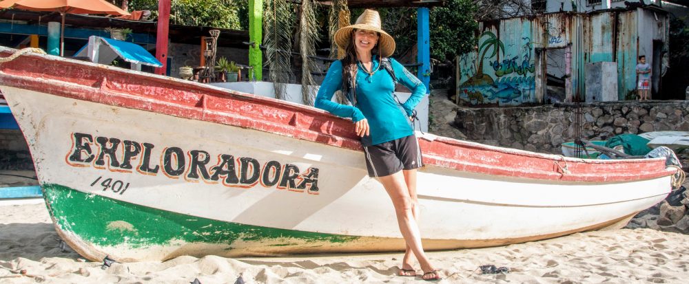

After nearly 5½ months and roughly 11,000 mi (17,700 km) of road tripping through Mexico, including a 3-week side trip to Cuba, Mathieu and I crossed the border back into the US and explored Arizona, Utah, Nevada, and California. How did we spend roughly 7 weeks in the wild wild west? Visiting friends and exploring amazingly beautiful landscapes, of course!
Click HERE to go directly to the full photo album or click “Continue reading” to find out more about our road trip adventure!
Arizona
After crossing from Nogales, Mexico into Arizona, we drove to Tucson to visit my good friends Erin and Sanjay and their kids Ishani and Aarav. It’d been over 3 years since I’d seen them so seeing their smiling faces was especially wonderful. We had a great time catching up, laughing and playing with the kids, eating delicious homemade Indian food, and relaxing. After a few days of being couch potatoes in their comfortable home, enjoying the AC and the wifi, we explored the area a bit and did a nice day hike in the Santa Catalina Mountains (Coronado National Forest), a beautiful area of jagged, rocky cliffs and flowering desert plants. How wonderful to live just a short drive from such a beautiful place.
From Tucson, we drove to Scottsdale to visit my good friends Dave and Nicole and their kids Gianna and Dominic. I’d visited them fairly recently but was super happy to see their smiling faces again. We spent several days with them catching up, laughing and playing with the kids, enjoying the pool, eating more delicious food, including Dave’s carne asada tacos, and being couch potatoes in their comfortable home. While in town, we visited The Penske Race Car Museum, bringing Dominic with us. After checking out the kick-ass classic race cars, we strolled through the showrooms of the adjacent luxury car dealerships for Maserati, Aston Martin, Ferrari, Jaguar, Rolls Royce, Bentley and more. While Dominic didn’t (at that time) have the vocabulary to say “whoa, these cars are frickin awesome!” Mathieu expressed the sentiment for him over and over again as we gawked at one beautiful, shiny, very luxurious, very expensive car after another. They were impressive for sure!
After a week of hanging out with our peeps and enjoying their hospitality, and their comfortable, air conditioned homes, we got back on the road (and back into the tent). From Scottsdale, we drove north a few hours and wild camped in the Coconino National Forest, just south of Sedona (thanks iOverlander). While looking for a campsite, we lucked out and saw a huge rattlesnake slowly crossing the dirt road in front of us. It was Mathieu’s first time to see one so we watched him for a while (from the safety of the truck), finally letting him be after he started rattling loudly at us. As much as I thoroughly enjoyed spending time with my friends, I’d already started missing being immersed in nature.
The next day, we continued north toward Grand Canyon National Park. Along the way, we briefly visited Sedona then stopped at the Bell Rock Pathway (still in the Coconino National Forest), unable to resist exploring the huge red-colored rock formations calling to us as we drove past. It’d be the first of many impromptu stops on our US road trip. Given the plethora of beautiful protected natural areas along our route, we couldn’t possibly visit them all and found ourselves saying “next time” a lot.
We arrived to Grand Canyon National Park in the late afternoon and joined the hundreds of other visitors along the south rim to view the impressive canyon and the surrounding canyonlands which extended as far as the eye could see. I’d visited the Park several times but it was equally impressive each time, although watching Mathieu’s response to seeing the famous canyon for the first time made this visit especially fun. With our beers cleverly hidden in our travel mugs (gifts from Dave and Nicole), we sat on the rim and watched the green-, purple-, red-, yellow-hued layers of the canyonlands change color in the fading light of the setting sun. It was wonderful. After our rim-side picnic, we wild camped in the Kaibab National Forest, just outside the south entrance to the Park (thanks iOverlander).
We spent four days exploring the southern part of the Park, during which we visited numerous overlooks along the rim trail, admiring the majestic canyon and the surrounding canyonlands from various vantage points. We also did an overnight backpack trip to the bottom of the canyon. We’d totally lucked out and got a last-minute backcountry permit to camp two nights at the Bright Angel Campground at the bottom of the canyon. Apparently the threat of high temperatures at the bottom scared a lot of people into canceling their reservations. Wimps. With our backpacks minimally loaded, we hiked down the 7-mi (11-km) South Kaibab Trail at sunrise. It was lovely to watch the sunlight spread across the canyon walls as we hiked deeper. After about 4.5 hours of very steep downhill hiking, we arrived to the bottom of one of the worlds deepest gorges. To celebrate, we dropped our packs at the campground then jumped, fully clothed, into the Colorado River. Despite it being ~115F (46C) in the sun [and ~98F (37C) in the shade], it was impossible to stay in the river for more than a few moments; the water was freezing! After a few hours laying in the shade of the trees in the campground, counting the minutes until the blistering sun went behind the high canyon walls, we day-hiked up the North Kaibab Trail to Ribbon Falls. The trail took us through the narrow canyon carved by the Kaibab River and to a small waterfall cascading down onto a huge rock formation. The fall was not spectacularly tall or voluminous, but it was a beautiful area and we had it all to ourselves.
The next morning, just before sunrise, we started the 10-mi (15.9-km) hike back up the canyon to return to the south rim. Our permit was for two nights but given the extreme daytime heat, we wimped out and decided one night was enough. The 4.5-hour hike back up the canyon was strenuous and hot but the beautiful views along the way were worth the effort. On our way out of the Park’s east entrance, we stopped at various overlooks to get last looks of the amazing landscape.
From Grand Canyon National Park, we continued north, hoping to find a cheap hotel in Page where we could blast the AC and take cold showers. However, a room at the typically-cheap Motel 6 was $199. WTF?! Oh right, it was a holiday weekend (Memorial Day). So, we had to forgo “luxury” and instead we camped on the shores of Lake Powell in the southern part of the Glen Canyon Recreation Area. The campground was crowded with hundreds of massive RVs but the nighttime temperature near the lake was lovely.
After a quick swim in the chilly lake the next morning, we backtracked a bit (via Highways 98 163) to drive through Monument Valley. Along the way, we stopped at Horseshoe Bend, a deeply-cut, horseshoe-shaped bend in the Colorado River. While the canyon rim overlooking the impressive bend was crowded with hundreds of people, it was a worthwhile stop. We also stopped at Antelope Canyon hoping to visit the narrow slot canyons renowned for their beautiful colors. Unfortunately, the hundreds of other people around us had reservations for a tour of this popular site; we did not. Next time. As we continued north through Monument Valley and into Utah, the views became more beautiful. We drove past tall, reddish brown mesas, towers and mushroom-shaped rocks jetting out of the flat desert landscape. At the town of Mexican Hat, we turned off the highway to visit Mexican Hat, a rock formation in the shape of…a Mexican Hat. It wasn’t very remarkable but it was a fun side stop.
Utah
After Mexican Hat, we took Highway 261 to get to Valley of the Gods, a protected area with more amazing reddish brown rock formations and mesas. We followed the 17-mi (27-km) self-guided driving tour through the area, winding through the massive rock formations with names like Rooster Butte, Setting Hen Butte, and Balanced Rock/Lady in a Tub. During our tour, we found a wild camping spot and watched as the sun set behind the giant mastiffs rising steeply from the desert floor, sharing the view with the few other campers scattered throughout the large area. The landscape was dramatic and beautiful, and peaceful.
After enjoying breakfast with an amazing view, we returned to Highway 261 and drove to Natural Bridges National Monument where we did a 10-mi (16-km) loop hike through a lovely shaded canyon to view the impressive natural bridges (aka arches). It was a very pretty area and since it’s a bit off the beaten path, there were only a few other visitors. After the hike, we drove through the town of Monticello where we turned onto State Road 211 and into the Indian Creek Recreation Area. The drive through the wide valley lined with impressive sandstone cliffs on either side was stunning, especially as the sun set. We camped at the Super Bowl Campground, which we had all to ourselves, and enjoyed another night gazing at the stars while bats flew overhead.
From there, we drove the short distance to Canyonlands National Park (Needles District). We hiked the Elephant Hill Trail, a 11-mi (18-km) out-and-back that took us through a narrow canyon to Druid Arch, a large arch named for its resemblance to the large rocks of Stonehenge. It was a great day of hiking among huge needle- and mushroom-shaped formations then scrambling up the canyon wall to view the massive Druid Arch. The arch was cool to see but the surrounding “forest” of formations was even more impressive.
After the hike, we continued to Moab, a city surrounded by some of the “most stunning red rock landscapes on Earth.” During a previous visit to the area, I’d camped at one of the dozen or so riverside campgrounds in the Colorado River Recreation Area. This time, however, all the campgrounds were full. Apparently we were not the only people who wanted to see “the most stunning red rock landscapes on Earth.” Thankfully just before giving up, we found a spot in an overflow camping area. There were no trees or picnic tables but we were just across the road from the Colorado River and the surrounding area was beautiful. Also, we were within 20 minutes of Moab and Arches National Park. After a bath in the icy river, we drove back to Moab to do laundry and resupply. However on the way, the needle on Genevieve’s (my 4Runner) temperature gauge suddenly shot into the red and the engine shut off. Crap. The truck was overheated but oddly there was no steam coming from the radiator. We sat roadside for about an hour to let the engine cool then drove back to camp. Since it was now evening, we joined our fellow campmates to cook dinner in the dirt parking lot and enjoy the sound of the river.
The next morning, we put some water in the empty radiator and slowly drove to Moab. We stopped at the first auto shop we saw and luckily they could take a look at the truck that morning. After a fairly quick inspection, they diagnosed the problem. The seal on the radiator cap was broken so the radiator fluid had leaked out in a slow, steady stream of unnoticeable steam. Along with checking the hoses for leaks, the primary fix was to replace the radiator cap. Of course we were relieved that we wouldn’t have to replace a cracked radiator or do other major repairs but….you may recall that while in Nogales, Mexico, the mechanic who flushed the radiator for us told us the seal was broken and that we needed to immediately replace it. Obviously, we’d forgotten his message so now what should have been a $10 repair was a $150 repair. Crap. It was also not lost on us that we could have burned out the engine anytime during the roughly 700 mi (1,126 km) we’d driven since leaving Nogales. So, despite our foolish mistake, we were feeling pretty lucky.
With the radiator now refilled with fluid and topped with a shiny new (very expensive) radiator cap, we explored Moab’s charming downtown area, visiting some of the many small shops filled with tourist souvenirs, local art, and expert photographs of the area’s stunningly beautiful landscapes. While strolling, we saw a flyer announcing a rodeo coming to town in two days. Per the flyer, the rodeo would feature the typical rodeo events and, there’d be kettle corn. Yes!!! We decided to stay another night to enjoy the festivities.
The next day, we visited Canyonlands National Park (Island in the Sky District) and hiked the 8.3-mi (13-km) Syncline Loop Trail. We hiked on the outer side of a huge crater for a few miles, then crossed over the rim and scrambled down a boulder field into the crater where we walked among huge boulders and domes of uplifted sediment. The area was truly a picture of upheaval. It was a great hike and we had the trail to ourselves. After the hike, we drove to the Green River Overlook where we had a beer while staring out over the vast expanse of dense canyonlands dramatically cut by the mighty Green River. The view was as amazing as it’d been during my previous visit and is still one of my all-time favorite views.
Back in Moab, we stopped at an RV park for a shower. We paid the owner, an ornery old lady who zipped around in golf cart, $2.75 each for a 5-minute hot shower. It was heaven. Now clean and smelling good, we got dressed up for a night out at the rodeo. We parked alongside the other dusty trucks and went into the small arena to join the crowd (mostly locals) on the bench seats to cheer on the barrel racers, cow ropers, and bull riders, and to laugh at the hilarious rodeo clowns who were crowd favorites for sure. While watching the cowboys get tossed around like ragdolls as they tried to stay on the backs of huge, pissed-off bulls, we sipped Moab brewery beer and ate nachos and sloppy joes, both smothered in bright-yellow “cheese.” This was Mathieu’s first rodeo, and his first sloppy joe, so it was an especially fun evening (as was hearing him say “sloppy joe” with his strong French accent).
The next morning, we got up super early and drove into Arches National Park. We drank our coffee while watching the light of the rising sun spread across the huge rock formations. We then joined the hundreds of other visitors to see the arches, including of course Delicate Arch, the Park’s most famous formation. Despite the number of people, the atmosphere at Delicate Arch was tranquil. It seemed we were all in awe of the impressive landscape, including the views of the distant snow-capped La Sal Mountains visible through the lovely arch. From the Park, we drove a scenic route through the beautiful canyonlands of Capitol Reef National Park to the town of Escalante. After refueling and resupplying, we then entered Grand Staircase-Escalante National Monument and found a wild camping spot (thanks iOverlander) where we enjoyed a peaceful night under the stars.
In the morning, we drove down Hole-in-the-Rock Road, a 56-mi (90-km) dirt road that ended at Lake Powell at the spot called Hole-in-the-Rock. Along the way, we stopped at the Dry Fork Trailhead to hike through some slot canyons. Exploring Spooky Slot Canyon, Peek-a-Boo Slot Canyon, and Dry Fork Narrows Canyon required us to scramble up, climb down, crawl, squeeze, and suck in our guts to pass through some very narrow sections of carved sandstone. It was awesome! We then continued to Hole-in-the-Rock to jump into Lake Powell. As floated in the refreshing waters of the lake looking back up at the trail we’d come down, it was hard to imagine how early settlers in the late 1880s managed to lowered their wagons, horses, and gear through this narrow, steep crevice in the 1200-ft (400-m) high cliffs of Glen Canyon. Per Wikipedia, the Mormon settlers worked for months widening the upper section of the crevice using blasting powder, and used hand chisels to carve anchor points into the sandstone so that the expedition of 250 people, 83 full-sized wagons, and over 1000 head of livestock descend down the cliff to cross the river (now Lake Powell). They used heavy ropes and teams of men and oxen to lower the wagons through the upper crevice, which has slopes approaching 45°. Wow. After hauling ourselves back up the steep trail, we found a nice spot on the cliff where we drank cold beer and watched the sunset.
The next morning, after watching the sunrise over Lake Powell, we returned the way we’d come, stopping at the Egypt Trailhead to hike through the desert, abloom with flowers, and through more beautiful canyons and formations. Much to our delight, the trail criss-crossed a wide, shallow river in which we submerged ourselves in multiple times. It was heaven and made the heat of the day tolerable. After the hike, we continued to the highway. It was heaven to be back on smooth pavement. The entire 112-mi (180-km) round trip drive on Hole-in-the-Rock Road had been on washboard. Along with rattling our brains, the constant vibration caused the screw holding the bike rack to the truck to vibrate loose. Thankfully we figured this out early, so avoided disaster, but since we couldn’t figure out how to prevent it, we had to stop every 20 minutes to re-tighten the screw. Given the multitude of truck and bike rack calamites we’d experienced on our road trip through Mexico and the US (thankfully minor), maybe I should write a post called “The adventures of Genevieve and her trusty sidekick, Billy Bike Rack” Ha!
From Grand Staircase-Escalante National Monument, we continued to Bryce Canyon National Park. Since we arrived near dark, we found a wild camping spot in the Dixie National Forest just outside the Park entrance (thanks iOverlander) and enjoyed a refreshing evening under the pine trees. The next day, we joined hundreds of other tourists visiting the Park. Perched on the rim, we looked down into the massive, wide canyon filled with extraordinary needle formations. The size and shape of the formations were amazing, as were their orangish yellow colors. We did a nice hike down into the canyon to walk through the stunning formations. After, we drove the scenic road along the rim, stopping at the various overlooks to view the expansive canyon from different angles. It’s a truly extraordinary place.
We then continued to Zion National Park. After a stop at the visitor center for hiking recommendations, we drove out of the Park to wild camp off Kolob Terrace Road, just outside the park entrance. The camping area was along a creek and was shaded by trees (thanks iOverlander). As soon as we found a spot, I immediately laid down in the small creek. There was barely enough water to cover my body but it helped me cool down. It was 4pm and at least 100F (38C). Yikes. We sat in the shade and spent the afternoon relaxing.
The next morning, we drove back into the Park to catch the shuttle. To reduce traffic and pollution, the shuttle was the only way to access the various trailheads throughout Zion Canyon in the summer. We’d read that prior to the shuttle, the road and parking lots would be congested with ~5,000 cars/day. Whoa. To avoid the masses, we took the 6am shuttle. [People in line for the later shuttles waited 45 to 60 minutes!] We hiked up to Observation Point, a view point on the canyon rim overlooking the North Fork of the Virgin River. On our way up the steep, switchback trail, we were fortunate to see a family of bighorn sheep. The views of the river at the bottom of the deep canyon where stunning and it was early enough that we shared the spot with only a few others. We also hiked up to Angel’s Landing, a trail known for its super narrow sections along the cliff edge where you have to hold on to permanently-anchored chains to prevent falling hundreds of feet to your death. A sign along the way reminded us of the dangers of the trail, informing us that 6 people had died since 2004 due to falling off this trail. It was a good reminder to hold on tight while enjoying the stunning views all around.
Along with visiting the main part of the Park, we also spent two days visiting the Kolob Canyon section of the Park (northwest of the main part of the Park). We hiked the Taylor Creek trail which took us through juniper/pine forest along Taylor Creek to the Double Arch Alcove. We passed a few other people but mostly had the trail to ourselves. It was a lovely hike and mostly in the shade, and the colors and patterns at the double arch alcove were beautiful. At the end of the scenic drive to Kolob Canyon Overlook, we looked out at the expansive chain of mountains while enjoying cold beers. It was an impressive sight and uncrowded.
After a night of wild camping in the Dixie National Forest outside the Kolob Canyon entrance (thanks Park ranger), we returned to this less-visited part of Zion and hiked the La Verkin Creek Trail. We again walked through juniper/pine forest, crisscrossing numerous small creeks. The view of the rocky, red-colored mountains was beautiful. We rounded the mountains then hiked along La Verkin Creek to Kolob Arch. It’s apparently the world’s largest free standing arch but given its position on the side of the cliff, it was difficult to see, let alone appreciate its size. After soaking in the clear, cold creek, we returned to the truck and drove to the Lake Mead National Recreation Area, crossing into Nevada, where we wild camped for the night.
Nevada
After a scenic drive along Lake Mead, we arrived to Hoover Dam. It was Mathieu’s first visit and he was impressed. We joined the crowds to peer over the edge of the 726 ft (221 m) tall dam. After walking the length the dam and marveling at this feat of engineering, we continued west. Next stop: Vegas baby.
Our room at The Linq (on the Strip) was very chic with a king sized bed, a giant flat screen TV, excellent AC, and a nice shower with big, fluffy towels. It was heaven. After showering and relaxing on the huge bed with the AC cranked up, we made some to-go cocktails and headed out. We could see from the large window in our room that the party was at the pool. We sipped our drinks while floating in the pool and jamming out to the DJ. Later that night, to-go cups still in hand, we walked The Strip, walking through the giant casinos, watching light shows produced by the mega hotels, and taking in the sights and sounds of Vegas. It was Mathieu’s first time there so he was excited to finally see the spectacle. And his beginners luck was with him at the roulette table. While he didn’t strike it rich, he won back what he bet plus some extra, and had a great time doing it. We’d planned to go dancing that night at Drai’s but ended up walking around so long (and having a few too many cocktails) that we were exhausted by midnight. Next time.
California
After a fun night in Vegas, we got back on the road, crossing into California and continuing to Death Valley National Park. Our first stop was Badwater Basin, the lowest point in North America at 282 ft (855 m) below sea level. It was 101F (38C) outside so it was a quick stop to take a “we were here” picture. As we continued the scenic drive through the Park, we stopped periodically to join the masses to enjoy the stunning views of the expansive desert and its many multi-colored layers of rock and sand. Given the extreme heat, we decided to camp at Mahogany Flat campground, a primitive campground located in the Panamint Mountains (still part of the Park). Our campsite in the trees overlooked the beautiful desert but since we were at an elevation of 8,133 ft (2,479 m), the temperature was significantly cooler.
After a good night of sleep under the stars, we hiked from the campground to Telescope Peak, the highest peak in Park at 11,043 ft (3,366 m). The views during the 14-mi (22-km) round trip hike were amazing as were the expansive views from the peak. We could see for miles in every direction and looked over Death Valley on one side and Panamint Valley and distant snow-capped peaks of the Sierra Nevada Mountains on the other side. The area is also home to ancient bristlecone pines. The oldest tree of this species was found in the nearby White Mountains and determined to be 5,067 years old. Wow.
After the fabulous hike, we drove south on Highway 395 through the Owens Valley. I’ve driven this highway numerous times but I never get tired of the varied desert terrain and the views of the mountains, especially of the majestic Sierra Nevadas. We cut through the lower Sierras via Highway 178 and camped for the night at the Walker Pass Campground, a campground also used by hikers on the Pacific Crest Trail or PCT (a 2,659-mi (4,279-km) hiking trail from the Mexican border to the Canadian border).
The next morning, after drinking coffee and watching (me with a tinge of envy) as the PCT hikers loaded up their packs, we drove north to Sequoia National Park. The views along the curvy road into the Park were beautiful and the temperature decreased slightly as we continued into the mountains. After a stop at the visitor center and pictures in front of “The Sentinel”, a very tall but apparently average sized sequoia tree, we took the Park shuttle to visit the Park’s famous sequoia, the General Sherman Tree. With a height of 275 ft (83.8 m), a diameter of 25 ft (7.7 m), an estimated volume of 52,513 cu ft (1,487 m3), and an estimated age of 2,300–2,700 years, it is among the tallest, widest, and longest-lived of all trees on the planet. Cool! We then continued north on Generals Highway and wild camped in the National Forest between Sequoia and Kings Canyon National Parks (thanks iOverlander). We found an awesome spot with views of the snow-covered mountains in the distance, and we had the area to ourselves.
The next day, we did a nice 9-mi (14-km) hike to visit the Redwood Grove, known for having the highest number of large sequoias in the Park. The trail wound through the forest along one side of a deep valley and up the other side. After being in desert landscape for the past few weeks, it was great to hike in the forest among such majestic trees. After the hike, we drove Highway 180 and entered Kings Canyon National Park. There are only a few campgrounds in the Park, so we were luck to get the last campsite in the Convict Flat Campground. To escape the heat at our unshaded campsite, we drove down the mountain to the Kings River. The views of the steep canyon walls cut by the large river were breathtaking, and the river was raging with snow melt. Since we couldn’t safely get into the water, we sat on the river bank and dumped buckets of icy cold water over ourselves. It was a super cold bath but much needed.
The next day, we continued to Roads End (the end of Highway 180). As we prepared our packs for a day hike, we noticed people gathering around two Park rangers. They were guarding a cage holding a large black bear. Apparently mama bear had been hanging around the area and had been trapped so the Park biologists could tag and release her in a more remote area. Her was nearby, crying out for her. We watched as he quickly and easily climbed up a very tall tree and out on one its limbs. The rangers moved the crowd further away as to not scare the cub into falling and thankfully, the little guy climbed back down. It was cool to see the bears but, for their sakes, I hoped they’d stay away from people after being relocated.
After watching the cub for a while, we hiked the Mist Falls Trail, a popular trail that crossed several creeks, all of which were raging, then climbed through Paradise Valley. Once we were out of the forest, we could see the snow-capped mountains in the distance and the U-shaped glacial cut valley we’d hiked out of. The view was awesome and I was very happy to introduce Mathieu to my absolute favorite type of landscape. He was in awe too. We had lunch above Mist Falls. The water fell with such force that the spray from the falling water was higher than the falls themselves! And the noise was deafening. After the hike, we returned on Highway 180, stopping along the way to enjoy more of the magnificent view, then drove (via Highway 41) to Yosemite National Park. We found a wild camping area just south of the Park’s south entrance (thanks iOverlander). There were many other campers (tents and campervans) in the forested area when we arrived at nearly 10pm but there was plenty of space for us all.
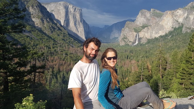
The next morning, we got up early and drove into the Park, stopping first at the Tunnel View overlook. The view looking down into Yosemite Valley was stunning. We could see Yosemite Falls and El Capitan on one side and Half Dome and Bridalveil Falls on the other. It was cool to see the famous icons of this world-renowned Park. I’d driven Highway 120 (Tioga Pass) through the northern part of the Park multiple times and visited Tuolumne Meadows, another of the Park’s iconic areas, but had never visited Yosemite Valley. We were both in awe and absolutely blown away by the beauty and majesty of the landscape. By 8:30am, there were already tons of people in the Park so we were lucky to get a parking spot near the visitor center. We loaded our daypacks and hiked the Yosemite Falls Trail. The super steep trail took us up along the lower and upper sections of the large, raging waterfall. At the top, we continued to Yosemite Point [elevation 6,936 ft (2,114 m)] which overlooked North Dome, Half Dome and glacial-cut valleys beyond. While we ate lunch, we watched dark storm clouds gather and start to move overhead. We got rained on a bit as we sat on the cliff edge but continued to marvel at the stunning view in front of us. On the way out of the Park, we stopped again at Tunnel View. This time, the sun was behind us and the combination of dark clouds and sunlight created an amazing light on the valley. It was nearly 8:30pm when we returned to our tent. We’d spent the entire day in the Park and had only visited Yosemite Falls. Ha!
We entered the Park early the next morning, determined to explore as much as possible on our last day there. We first visited Mirror Lake, enjoying the reflection of the trees and cliffs on the glass-smooth lake. We then joined a few hundred other people to hike to Vernal Fall. The hike followed the raging river, steadily going up to the falls. About a mile below the falls, we started to see people putting on rain gear. My first thought was “lame, what’s a little spray.” But as we climbed higher, I started to see people returning from the fall totally drenched. Hmm…I guess those lame people had the right idea. We got totally soaked by the icy spray but thankfully the sun was out to warm us up. It was crazy how many people were on the trail but it didn’t diminish the splendor of the fall. From there, we continued up to Nevada Fall, another beautiful waterfall. From there, Mathieu turned back (due to an injured knee) and I continued another 10 mi (16 km) to Glacier Point, a vista overlooking the valley and the expanse of snow-covered mountains beyond, then back down into the valley on Four Mile Trail. The views from the trail were stunning and there’d been significantly fewer people. It was awesome. On the way out of the Park, we stopped again at Tunnel View for one last look over the magnificent valley. Yosemite National Park is a truly special place.
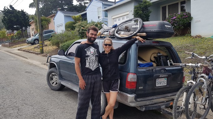
We then drove the four hours to my parent’s house in Pacifica (just south of San Francisco). It was the official end point of our road trip. We’d driven 3,695 mi (5,946 km) through the western US. During this 35-day section of the road trip, we camped 26 nights (17 nights wild camping and 9 nights in paid campgrounds), stayed with friends for 7 nights, and stay one night in a hotel (Vegas baby). And during this time, we visited some amazingly beautiful natural areas and, realized that there are so many more to visit in the future.
It was strange to imagine that after roughly 6½ months, our road trip was over. In total, we’d driven 14,445 mi (23,247 km) through Baja, mainland Mexico and the western US. During the trip, we had a few minor issues with Genevieve (i.e., flat tires, worn out brake pads, broken radiator cap), destroyed one of the two bicycles we brought, damaged the bike rack (likely beyond repair), and lost some of our gear and had to replace one of Genevieve’s side windows due to a smash-and-grab vehicle theft. But, we had an amazing experience, met wonderful and interesting people and visited some extraordinary places, many of which were off-the-beaten path. And best of all, I shared this epic journey with my wonderful road trip partner/boyfriend, Mathieu. This road trip has ended but we will hit the road again…when and where is TBD…
Here are a few pictures. Click the link to see the full album: https://photos.app.goo.gl/xA5TWF3mCKDjajyK8
Enjoy!
[Next post: Trekking the John Muir Trail!Stay tuned!]

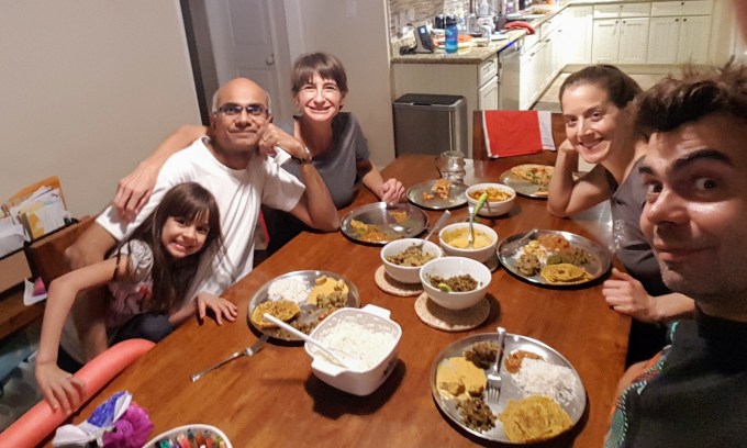
With our fabulous friends in Tucson, Arizona.

With our fabulous friends in Scottsdale, Arizona.

Happy hour at Grand Canyon National Park, Arizona.

At Droid Arch in Canyonlands National Park, Utah.
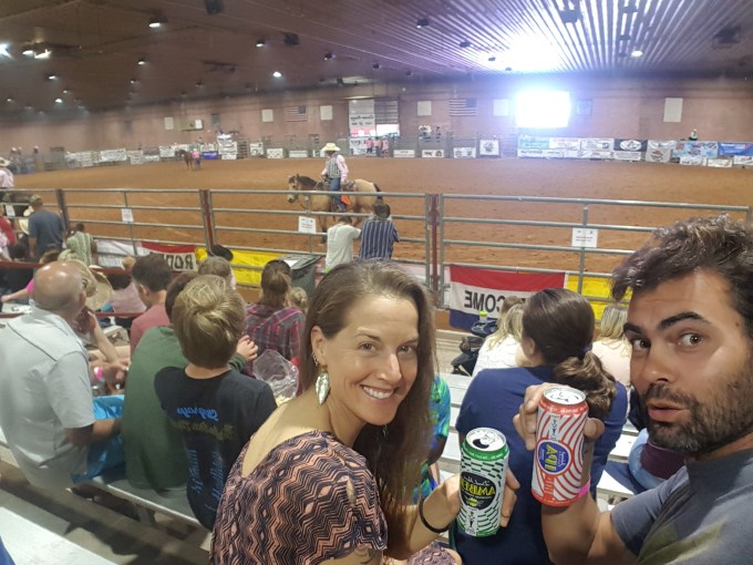
At the rodeo in Moab, Utah.

Overlooking the Green River, Canyonlands National Park, Utah.
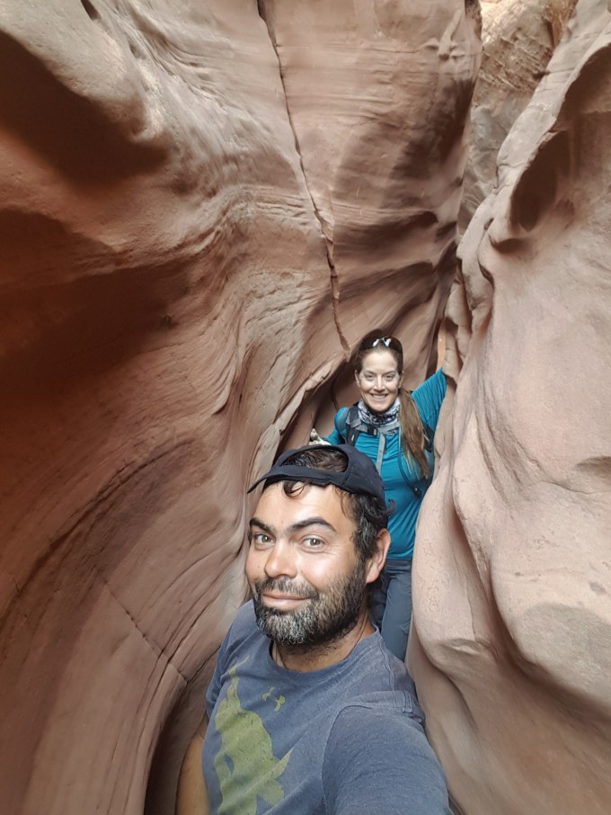
Squeezing through a slot canyon in Grand Staircase-Escalante National Monument, Utah.

Bryce Canyon National Park, Utah.
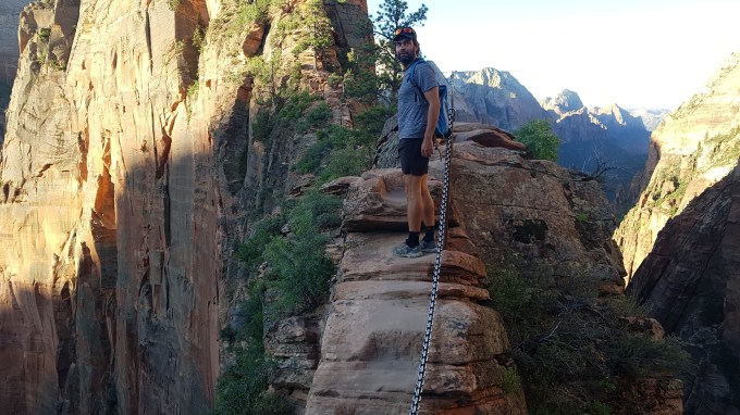
On the way to Angel’s Landing in Zion National Park, Utah.

At the lowest point in the US in Death Valley National Park, California.
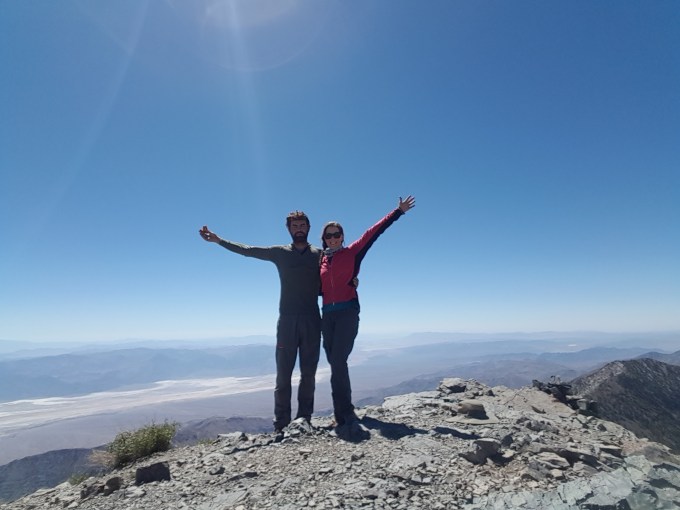
On top of Telescope Peak in Death Valley National Park, California.

Vegas baby!
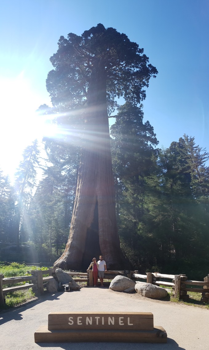
Dwarfed by a giant at Sequoia National Park, California.
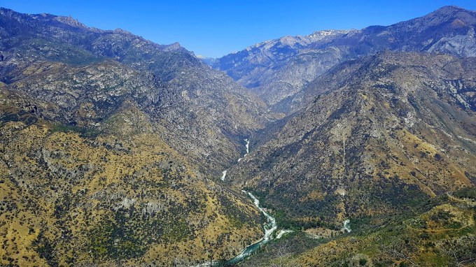
Overlooking Kings Canyon in Kings Canyon National Park, California.
Overlooking Yosemite Valley in Yosemite National Park, California.
And the road trip ends at my parent’s house in Pacifica, California.

Jarle Thorsen itel global group, Jarle Thorsen SiteTalk, Jarle Thorsen GLOBAL POWER PTE LTD, Jarle Thorsen itel global group, Jarle Thorsen Singapore
LikeLike
Another amazing adventure. So amazing my feet hurt and I`m out of breath. I need a few days before I read the next blog! I am so glad you are living your dreams. Tons of that stuff, DAD
LikeLike
Thanks much dad for always being my biggest cheerleader. The next one is way shorter, I swear!🤠
LikeLike
Just spent a magical 25 minutes reading about and soaking up your road trip. It brought back great memories of some of our trips a while back! The rattle snake in Arizona would not have pleased me! Looking forward to getting updated on your latest travels! love, Aunt Pat
LikeLike
I’m so glad you enjoyed sharing our adventures in this “magical” part of the country. I look forward to exploring new parts of the US in the future. More road trips! xoxo
LikeLike