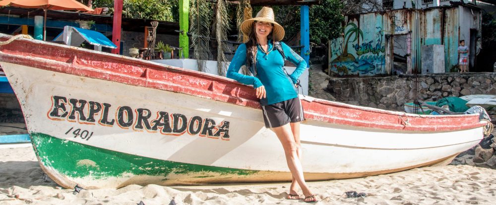
During my 2017 visit to California, my friend Carrie and I hiked the John Muir Trail, spending 23 days backpacking through the Sierra Nevada mountains (see previous post). Being my favorite mountain range in the US, I was excited when my friend Samantha suggested we do a backpacking trip in the Sierras during my 2018 visit. This time, my trek in the “Range of Light” was in the Hoover Wilderness (north of Yosemite National Park in the Inyo and Humboldt-Toiyabe National Forests), an area of the Sierras I had not yet explored.
Click HERE to go directly to the full photo album or click “Continue reading” to find out more about our 7-day hiking adventure!
After picking me up at my parent’s house in Pacifica (California), Samantha, her pup Fahren (aka “fox bear”), and I drove about 5 hours to the town of Bridgeport. The drive through the Sierras via Sonora Pass (Highway 108) was beautiful despite the large areas of forest that had unfortunately burned during the recent wildfires. We picked up our backcountry wilderness permit (self-issued after October 1st) then found a wild camping spot near Twin Lakes (thanks iOverlander). We spent the evening checking our gear, packing our backpacks, sipping some Fireball whiskey, chatting nonstop and watching for shooting stars.
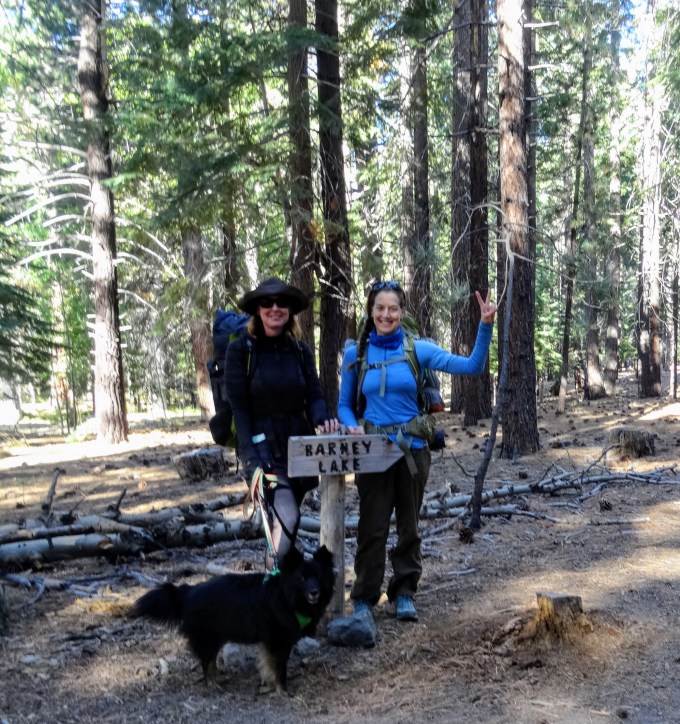
The next morning, we parked at Mono Village Campground and started our trek up the Robinson Creek Trail, walking through strongly scented sagebrush then through forest that was ablaze with fall colors, and onward into the mountains. We stopped for lunch at Barney Lake, a gorgeous little lake surrounded by jagged mountains. While enjoying the beautiful views, we were joined by three fellow hikers. As we chatted with them, we learned that these three men (about 70ish) had hiked to Barney Lake together every year for the past 40 years. Wow, what an amazing annual tradition! After lunch, we continued up to Peeler Lake, a large lake where the granite formations dropped off into the deep blue water. We found a great camp spot near the lakeshore, set up camp, and enjoyed the scenery and the serenity.
The next morning, after a lovely sunrise, we day hiked from camp to Kerrick Meadow, a large meadow in a broad valley. The vegetation was dry and brown but it was obvious that after the rainy season it would be lush green and teaming with life. Despite the lack of much water and the warm weather, we found a patch of ice crystals growing up out of an area of moist, sandy soil. It looked like translucent taffy growing out of the ground. We were lucky to have seen it before the intense sun melted the formations back down. As we walked, we talked. In fact, we talked so much that we ended up hiking twice as far as we’d planned. On the way back, we were vigilant in looking for the trail sign marking our intended turn-around spot, totally convinced it did not exist. Not only did we find that sign, but we found two other trail signs at the same junction: one along our trail and the others at the start of the intersecting trail. We had walked past not just one but three trail signs all immediately adjacent to the trails and well within plain sight. I’d be lying if I didn’t admit that this was NOT the first time in our 13+ years of friendship we’d missed a road or trail sign (hey Sam, remember that time we almost ended up in Sacramento? Ha!). What can I say, we talk a lot!
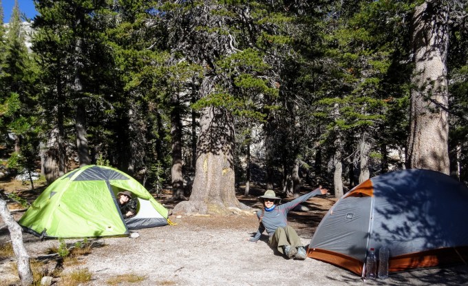
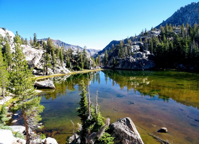
After two nights at Peeler Lake, we packed up and hiked to Crown Lake. Along the way, we passed through more dense pine forest and rocky landscape and past Robinson Lakes, a series of small lakes linked by a creek. The lakes were very shallow but stunning. Through the clear water, we could see the algae and other aquatic vegetation growing from the lake bottom, coloring the lakes beautiful shades of green and brown. And since the lake surfaces were absolutely still, they offered a perfect mirror reflection of the beautiful surroundings.
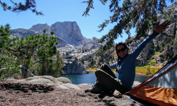
At Crown Lake, a large, deep lake surrounded by steep cliffs, we found a great camp spot, this time just above the lakeshore. After setting up camp, Samantha took a dip, Fahren chilled in the sun, and I hiked to Rock Island Pass. After hiking up the steep, switchback trail, I arrived to Snow Lake, another large, beautiful lake, then continued the short distance the pass. While Rock Island Pass is at 10,150 ft (3094 m), the scenery wasn’t nearly as dramatic as many of the other mountain passes I’d been over in the Sierras. But the area was beautiful and the hike was very relaxing, especially since I had the trail to myself and listened to some great music along the way (Coldplay on the way up and Ed Sheeran on the way down). Awesome.
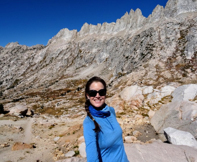
The next day, we hiked to Mule Pass. As Samantha and I zigzagged up the steep, switchback trail, Fahren bounded up, down and to both sides of the trail hunting (but not catching) squirrels, chipmunks and anything else that moved. She must have run 2 miles for every mile we hiked! The little fox bear had a blast for sure. As we continued, we passed a huge snow patch, the only snow we’d see during the entire trek, and a lovely little lake situated in a lovely little meadow. After another steep climb, we arrived to Mule Pass (10,470 ft; 3191 m). The view was stunning. We overlooked a deep, wide, glacial-cut valley fringed on one side by jagged mountains. We soaked in the view for awhile then Samantha and Fahren started back down the trail to base camp, and I continued to Burro Pass.
It was cool to hike through the valley we’d been overlooking. Once in the valley, the trail followed a lovely creek through the pine forest, then went through dry, rocky meadow and climbed up to the pass. The views from the 10,650-ft (3246-m) Burro Pass were stunning. In both directions, I looked down over wide, deep valleys fringed by jagged mountains, including the aptly named Sawtooth mountains. After many pictures and some video, I started the hike back. Along the way, I couldn’t resist the urge to take a dip in a deep pool in the crystal-clear creek. It was a quick dip (cuz it was darn cold) but it felt wonderful to let the sun dry me as I enjoyed the serenity. I’d had the pass and the entire trail to myself. It was heaven. When I got back to base camp, Samantha was reading a book and Fahren was chilling in the sun. I joined them in enjoying our tranquil spot and took a nap. That night, we sat on a rock ledge and chatted (more) as we waited for the full moon to illuminate the lake. We watched as the moonlight slowly crept down the steep cliff faces toward the lake but eventually we got too cold and called it a night. It was nice to fall asleep, as we’d done the previous nights, under the soft light of the moon.
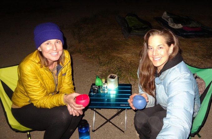
The next day, we hiked back the car, stopping again at Barney Lake for a last look and a quick dip in the beautiful little lake. Back at the campground, we took hot showers then drove back to Bridgeport to check out the Big Meadow Brewing Company. We drank a handcrafted beer and chatted with two other patrons and Rose, the owner, who told us she and her husband (the brew master) had opened their doors just 3 months prior. It was a super cool, dog-friendly space to enjoy a delicious local beer. After, we found a nice wild camping spot along Sonora Pass (thanks iOverlander) where we enjoyed the last night of our trip before returning home. We toasted some tequila, ate chips and salsa, and recounted our adventure in the Hoover Wilderness.
We had a great time exploring the gorgeous lakes, forests and dramatic mountains of the wilderness area, especially since we saw very few other people during our trek. We had the lakeside campsites totally to ourselves and had passed only a few other hikers on the trails, including the three guys doing their 40th annual day hike to Barney Lake, “Brian the Mountain Lion” and his two friends who we met on the last day of their 14-day trek in the area, and a brother/sister duo who were doing their 2nd annual Sierra trek (reminding me of the many Sierra treks my brother and I have done over the years). But the best part of the trek, besides being in my favorite mountains, was being there with Samantha, one of my favorite people in the world, and Fahren, one of my favorite pups. It was truly wonderful.
Here are a few pictures. Click the link to see the full album of pictures and videos: https://photos.app.goo.gl/RKn9rhDJeeJeAio26
Enjoy!
[Next post: Motorcycling around the French island of Corsica. Stay tuned!]


A beautiful trek for two beautiful women! Amazing pics T! Kuddos to ending your hike with tequila 🙂
LikeLike
Thanks for reading Flea! Tequila – of course: )
LikeLike
You make me wish I was 20/30 years younger – I would head out and copy your itinerary!
LikeLike
Thanks for reading aunt Pat. I’m happy you enjoyed the virtual trip through the mountains with me. xoox T
LikeLike