Ecuador: Cuenca/Parque Nacional Cajas and Latacunga/Volcan Cotopaxi/Quilatoa Loop (June 23 to July 4, 2015)

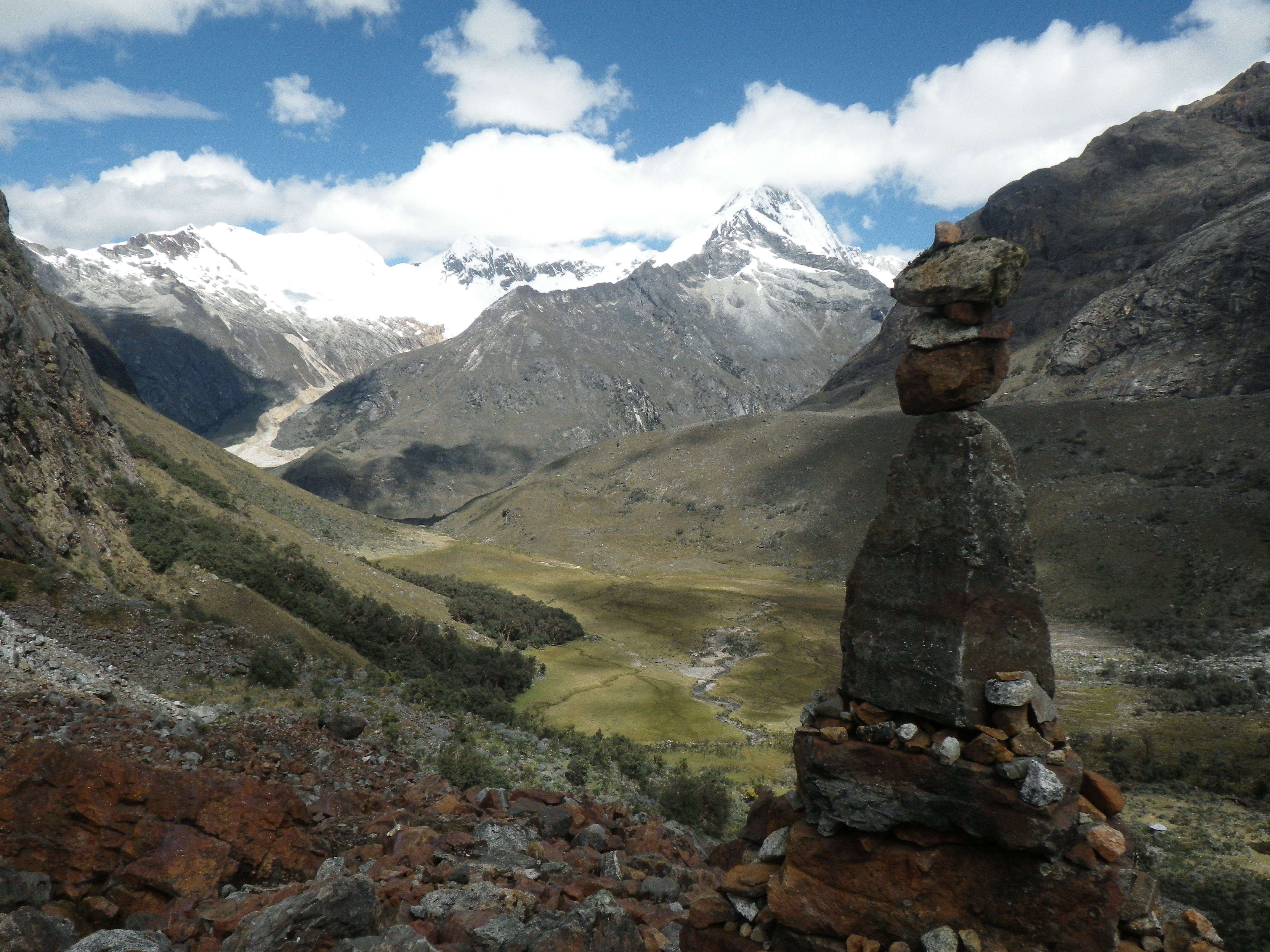
After hiking the amazing Santa Cruz trek in Peru (see previous post), I took an overnight bus, an all day bus, and another overnight bus to Cuenca, Ecuador.

Per Wikipedia, Cuenca is the third largest city in Ecuador (population ~400,000) located in the Andean highlands at about 8,200 ft (2500 m). It was declared a UNESCO World Heritage Site in 1999 for its charming historical center, its 52 churches, the small cobbled streets and colonial houses with noble facades, wrought iron balconies and red tiled roofs. Besides being a center for culture and art, Cuenca is also the gateway to Parque Nacional Cajas, a high-elevation area [10,170 to 14,600 ft (3100 to 4450 m) which contains about 270 lakes and lagoons surrounded by tundra with jagged peaks, gnarled red Quenua trees and cloud forest.

So how did I spend 5 days in a UNESCO World Heritage city and the nearby national park? Exploring and trekking of course!

In Cuenca, I reconnected with Renata and Gabriela (Czech Republic) who I’d met in Cusco (Peru) and with who I hiked the Santa Cruz trek. We spent a few days exploring the quint, beautiful city of Cuenca, enjoying the lovely plazas and churches and the delicious food at the local markets. After a few days in the city, we decided to do a 3-day trek in Parque Nacional Cajas. Unfortunately due to high winds, rain, and cold temperatures, we instead did a day hike that while beautiful was very wet and muddy, then spent the night at a refugio (instead of camping), and returned to Cuenca the next day. Back in town, we spent the day washing our muddy gear and deciding where to go next. I said farewell to Renata and Gabriela who headed to the coast for some sun and beach time, and I headed further north in Ecuador for more trekking.

After an overnight bus from Cuenca, I arrived in Latacunga (population 98,355), located on a plateau at about 9,200 ft (2,800 m) which serves as the gateway to Parque Nacional Cotopaxi, home of Volcan Cotopaxi. The active Cotopaxi volcano, the second highest summit in Ecuador at 19,347 ft (5,897 m), is only about 15 mi (25 km) from Latacunga. Per Wikipedia, “Volcan Cotopaxi erupted violently in 1742 and again in 1768, destroying much of Latacunga both times. The indomitable (or foolhardy) survivors rebuilt, only to have an immense eruption in 1877 wreak havoc a third time. Not to be outdone by Mother Nature, the townspeople were compelled to try again, and they have been spared Cotopaxi’s wrath ever since.” Until recently, the last eruption occurred in 1940. However, on August 14, 2015, about 6 weeks after I was there, the volcano erupted “with a series of six very strong explosions that produced ash plumes and some pyroclastic flows. In response, the Ecuadorian government declared a state of emergency for the area around the volcano and ordered more than 400 people to evacuate from the village on the northern foot of the volcano.” As far as I can tell, no one was hurt and no property was damaged by the eruptions. Too bad I missed it, it would have been exciting to see the volcano erupt!

Along with Volcan Cotopaxi, Latacunga is also the gateway to the Quilatoa Loop, a 3-day trek through several Andean villages that allows a glimpse into rural, indigenous life while enjoying majestic canyons, lagunas, and volcanoes. The trek is made famous by the Quilotoa crater lake. Per Wikipedia, the 2 mi (~3 km) wide caldera was formed by the collapse of the volcano following a catastrophic eruption about 800 years ago.

So how did I spend 7 days in an area of large volcanoes, deep canyons, and indigenous villages? Exploring and trekking of course!

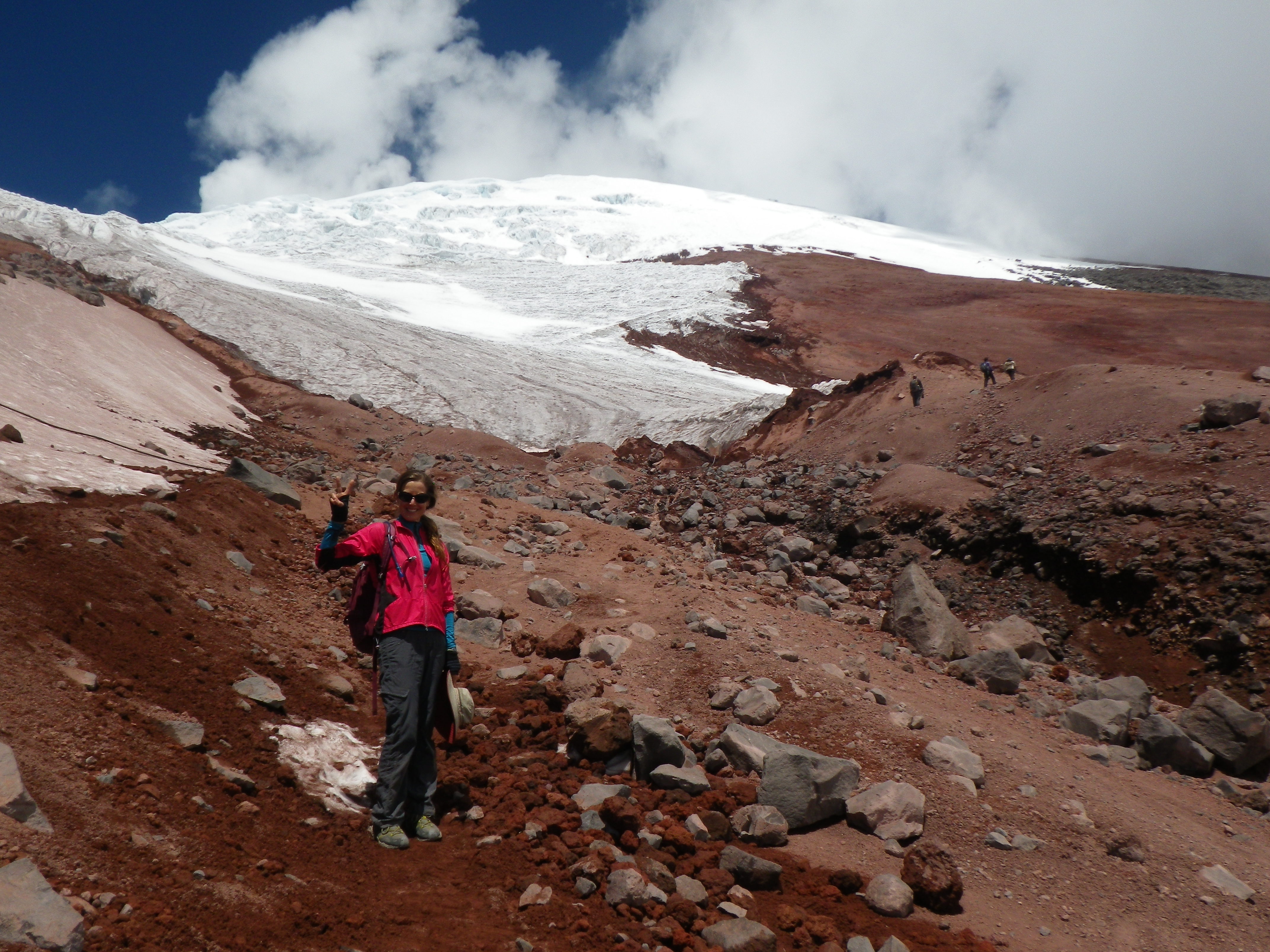
I started with a day-hike on Volcan Cotopaxi with my hiking partners, Benjamin and Jasmin (Germany) and Jason (Canada) who I’d met at the hostel in Latacunga. We took a bus to the national park where we hired a guide to take us to the foot of the glacier (the furthest point before technical climbing gear is required). While the trek to the glacier is steep, it’s short (about 45 minutes) and not technical, requiring only willpower to complete. However, the national park requires hikers to hire a guide to accompany them at least to/from the trailhead. Our guide, Patricio, was fantastic, sharing information about the geology and natural history of the area and the volcano. He seemed to genuinely enjoy hiking and talking with us as much as we did with him. Amazingly, he hikes the trail almost daily, guiding tourists to the glacier, and still loves it each time. A true hiker. The views of the surrounding landscape were stunning from the edge of the glacier located at 16,732 ft (5100 m). It was a great day-hike up a majestic volcano with fun people, including our guide, Patricio.

Next up, the Quilatoa Loop. With my legs warmed up from the volcano hike the day before, I packed my gear and headed to the trailhead with Alex (England), whom I’d met at the hostel that morning, and Benjamin. After a 2.5-hour bus ride, we started the 3-day, roughly 25-mi (41-km) trek. The loop is typically done starting from the village of Quilatoa, adjacent to Quilatoa crater lake. However, we opted to hike the reverse direction from Sigchos so we’d be rewarded with views of the stunning crater lake at the end of our trek. We hiked through wide canyons, pasturelands dotted with cows and sheep, and up and over several steep ridges. On the first night, we stayed at a lovely hostel in the village of Isinlivi which, along with a gorgeous view, comfortable beds, and hot showers, included a delicious home-cooked dinner and breakfast. This was luxury trekking for sure!

The next day we hiked to the village of Chugchilan. There, we said farewell to Benjamin who was meeting Jasmin and staying the night before they continued on to Quilatoa. Alex and I planned to hike to the crater that day and stay in Quilatoa that evening. However, later that afternoon, we ended up hiking with Eduardo and his younger sister, Yolanda, who were moving a small herd of cattle to higher pasture. After chatting for awhile, Eduardo invited us to stay at his family’s home located just below the crater. While there was no toilet or shower, for $5 each, we would have our own rooms, dinner, breakfast, and best of all, the company of a local family. We accepted the invitation and continued our hike to the Quilatoa crater. While less than half the width of Crater Lake in Oregon (5 mi (8 km) wide), the Quilotoa crater and its sparkling blue lake was an equally impressive sight.

After enjoying the late afternoon views of the lake and surrounding mountains and valleys, we hiked the short distance back down the hill to Eduardo’s house. Besides Eduardo (age 26) and Yolanda (12), the small three-bedroom house was shared by their mom Manuela, dad Espirtu, grandmother Josephina, grandfather, little sister Priscilla (3), and little brother Moses (2). Three other siblings, ages 19, 21, and 30, lived in Latacunga. Like most households, the kitchen was the central gathering place. The simple room consisted of several small stools and a table positioned around an open fire on the dirt floor. There were pots and pans of various sizes stored on the floor below a few shelves holding bowls, plates, cups, and silverware. In the corner, there was a small cabinet containing dried herbs and teas and other pantry staples. The only kitchen gadget I could see was a hand grinder mounted on a small table used to grind grains for cooking. While the family was Quechua, Spanish was our common language. Alex and I spent the evening talking and laughing with the family. I noticed immediately that they were all very affectionate with each other and laughed and smiled a lot. They all seemed to like having us there and laughed warmly as we played with the little kids and fumbled through our Spanish. They really had a good laugh as Alex helped Eduardo cut up a cow leg with a hacksaw. It was harder than it looked! For dinner, we were served large bowls of hot sopa de avena y leche (soup of oats and milk) with boiled potatoes on the side. The soup was creamy and delicious. After dinner, I retired to my room (which was Eduardo’s bedroom) and slept well after a long day of hiking and a wonderful evening amongst new friends.

The next morning, the family was up early. There was a huge pot of boiling water on the fire to which mom Manuela added onions, potatoes, spices, and the pieces of cow leg and feet that Alex helped cut up the night before. While the soup was cooking, Alex and I joined the family in de-kerneling raw corn. Eduardo’s family grew corn and sold the kernels at the markets in nearby villages. The husks and other food scraps were fed to the family pig. After simmering for a bit, we were served the soup for breakfast. I thought that perhaps the cow leg and feet were added to the soup to provide flavoring. Nope, they were part of the dish. I’ll admit I got a little anxious as I was served a huge bowl of soup with a giant cow foot in it. I sipped the rich broth and ate the potatoes and onions for awhile while I watched how the family tackled the feet. Okay, so you pick it up, eat the “meat” off the bone, then suck out the bone marrow. Given that it was the foot, the “meat” seemed to consist of the skin (hair removed), tendons, and cartilage. All eyes were on Alex and I as we picked up our cow feet, ate the “meat”, and sucked out the marrow. They found our efforts very amusing. I ate all of the broth, veggies, and bone marrow but got out of eating the rest of the “meat” by saying I was full and giving the rest of my foot to Eduardo. After breakfast, Alex and I packed our bags, took pictures, and said farewell to our host family. It had been an wonderful and unforgettable experience. We hiked back up to the crater, enjoying the amazing lake views from the rim trail. Once in Quilatoa, we had a snack, reminisced about our trek, particularly about our evening with Eduardo and his family, and caught the bus back to Latacunga. It had been another wonderful trek with fun people!

Exploring and trekking in Ecuador was a fantastic experience made even more special by the new friends with whom I shared the experience, including the wonderful family that welcomed me into their happy home.

Here are a few pictures. Click the links to see the full photo albums:

Cuenca & Parque Nacional Cajas:  https://goo.gl/photos/AZ24aDZtyvYfMxAb6

Latacunga & Volcan Cotopaxi/Quilatoa Loop:  https://goo.gl/photos/VSptsZtT8tKAs5r69

Enjoy!

IMGP0051
Hiking up Volcan Cotopaxi.
IMGP0091
View of Volcan Cotopaxi from the hostel in Latacunga.
IMGP0064
With Jason, Patricio, Jasmin, and Benjamin at the edge of the Volcan Cotopaxi glacier at 16,732 ft.
IMGP0146
With Benjamin and Alex on the Quilatoa Loop.
IMGP0238
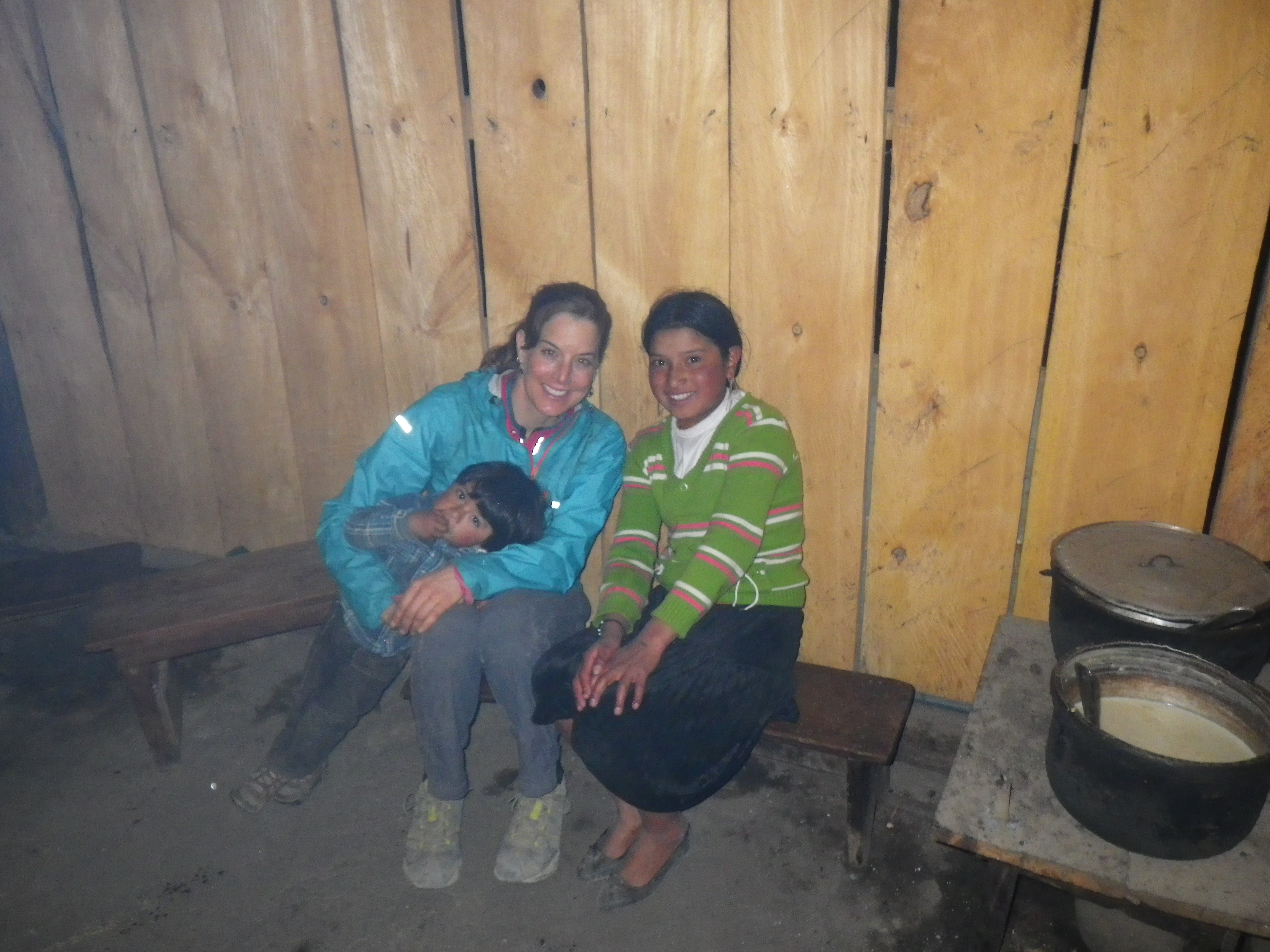
With Moses and Yolanda in our host family’s home below the Quilatoa crater.
IMGP0231
With Alex enjoying sopa de avena y leche.
IMGP0216
At the Quilatoa crater lake.
IMGP0033
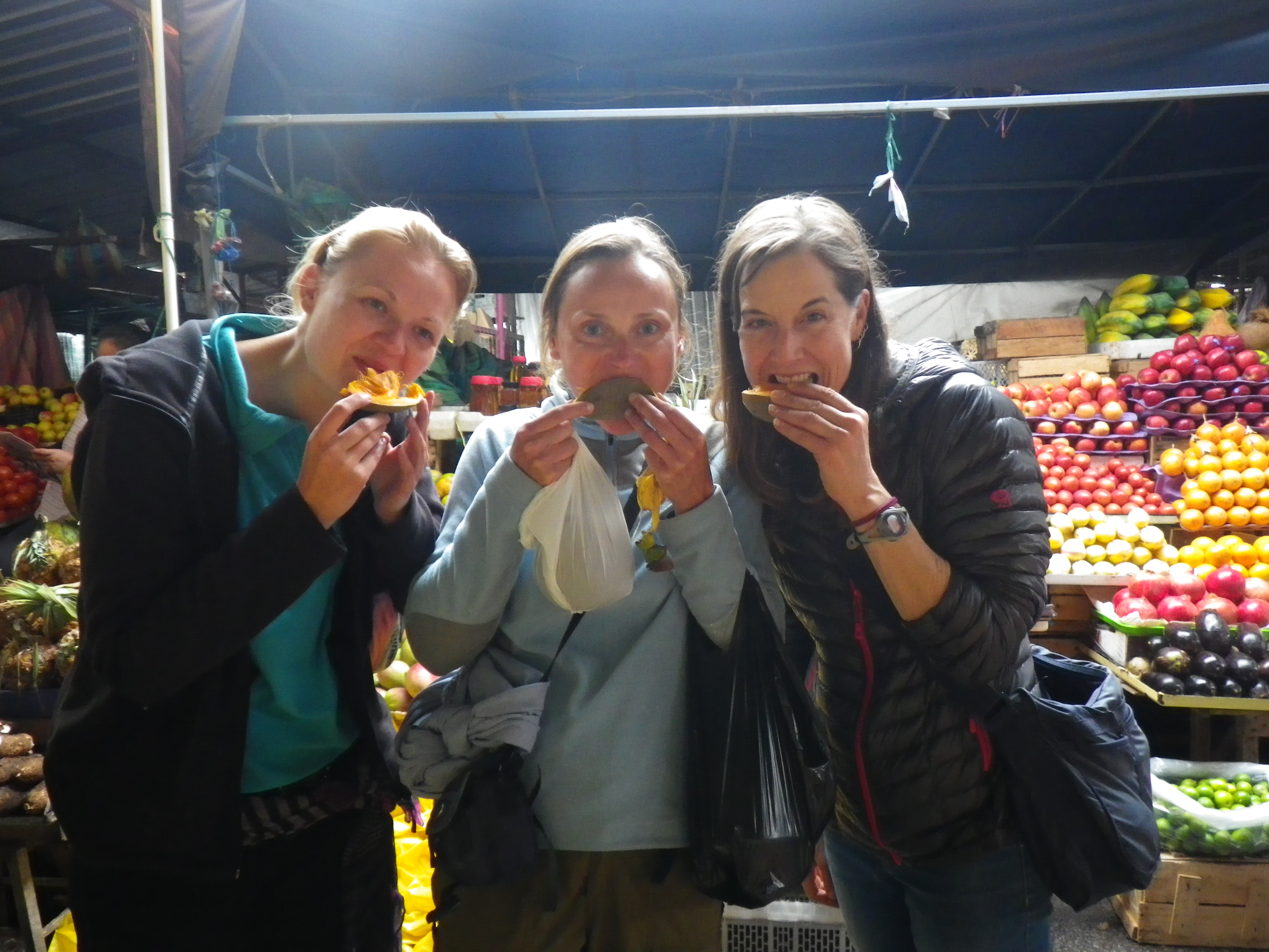
Trying new fruits with Gabriela and Renata at a market in Cuenca.
IMGP0042
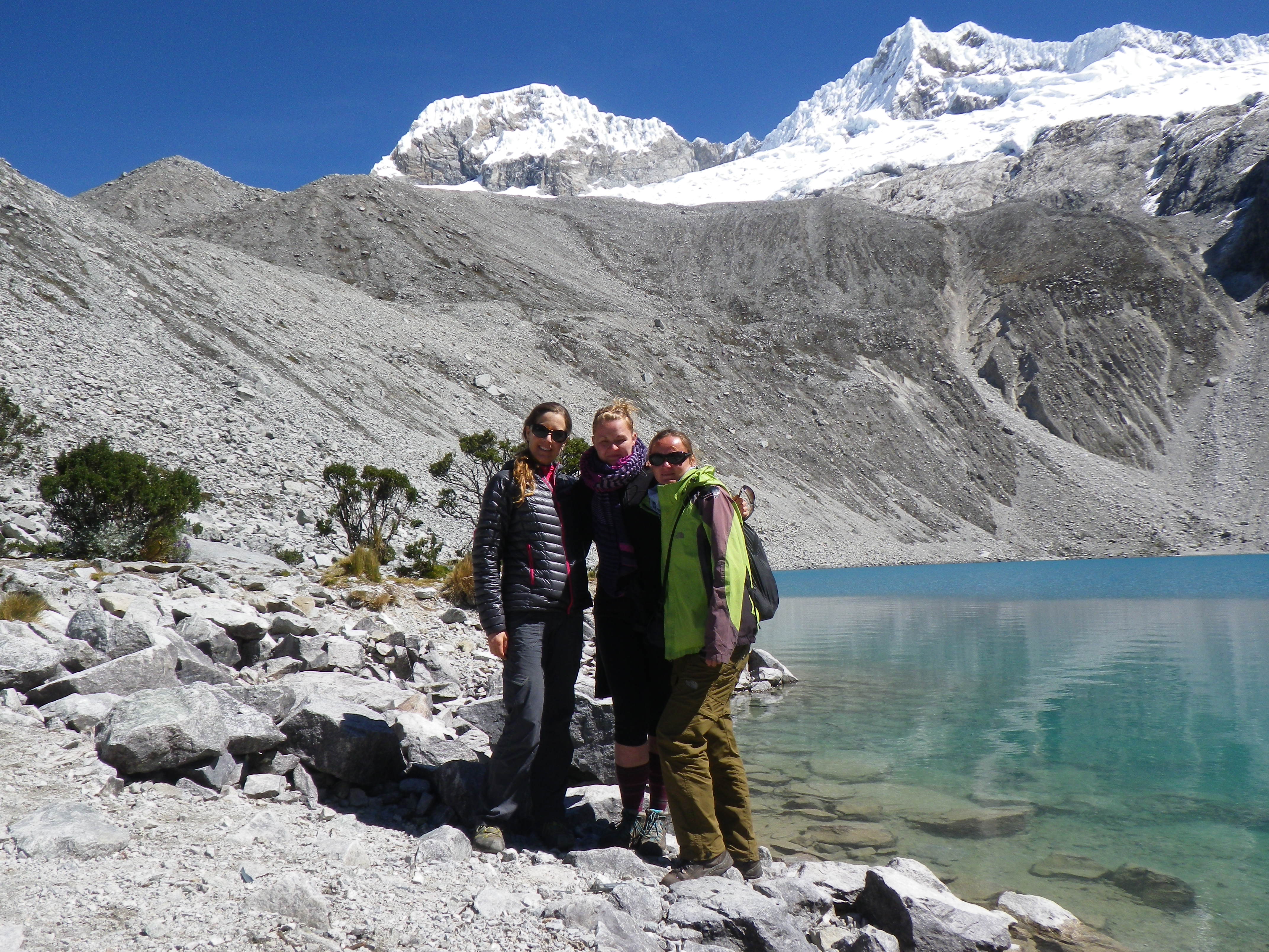
With Gabriela and Renata at Parque Nacional Cajas.

Travel notes: recommend Hostal Santa Fe, Cuenca (nice owners, good wifi, cheap, no shared kitchen), Hostal Tiana in Latacunga (friendly staff, good wifi, good shared kitchen and patio), and Hostal Taita Cristobal in Isinlivi (on the Quilator Loop); tap water in Ecuador is NOT potable (treatment needed).

Peru: Huaraz/Parque Nacional Huarascan (June 13 to 20, 2015)

After almost 8 weeks in Bolivia (see previous posts for Cochabamba, Salar de Uyuni, Parque Nacional Madidi, and Lake Titicaca), it was time to cross the border into Peru. From Copacabana, Bolivia, I took an overnight bus to Cusco, Peru, where I stayed for two nights. Since I’d visited Cusco three years earlier, I spent my time relaxing, journaling, and talking to people at my hostel, only venturing out to get food at a nearby local restaurant or at the local market. At the hostel, I again ran into Mathieu (France) who I’d met in Bariloche (Argentina) then ran into in Copacabana. That’s what happens on the travelers circuit. While at the hostel, I also met Renata and Gabriela (Czech Republic) who were on their way to Huaraz, Peru to do the Santa Cruz trek. After talking to them, I recalled that this trek was featured in an article in Backpacker magazine that I’d been carrying around with me all over South America. I’d planned to move quickly through Peru in order to get to Ecuador, but after more research, I changed my plan and decided I had to do the Santa Cruz trek. So, after an overnight bus from Cusco to Lima, where I stayed for a night, and another overnight bus from Lima, I arrived in Huaraz, Peru.

Per Wikipedia, Huaraz (population 100,000+; elevation 10,013 feet) is the main point of entry for climbers and hikers wanting to tackle the glaciers and mountains of the Cordillera Blanca, the world’s highest tropical mountain range, located almost entirely in Parque Nacional Huascaran, a UNESCO nature world heritage site. The Cordillera Blanca range contains 722 individual glaciers and 33 major peaks over 18,040 feet high, including Peru’s highest mountain, Huascaran which is 22,205 feet high.

So how did I spend 8 days amongst glaciers and high mountain peaks? Trekking of course!

During the first three days in Huaraz, I reconnected with Renata and Gabriela, and befriended Peter and Dustin (Canada), who’d I’d met at the bus station in Lima. Together, we ate local Peruvian food and explored the local markets. As a warm up, Renata, Peter, Dustin, and I day hiked to Laguna Churup, a gorgeous glacial lake at 14,600 feet. Then after a day to rest and stock up on supplies, all five of us headed to Parque Nacional Huascaran, Peter and Dustin to do some climbing and Renata, Gabriela, and I to do a 5-day trek, four days on the Santa Cruz trail and one day hiking to Laguna 69, a gorgeous glacial lake.

We started the roughly 30-mile Santa Cruz trek in the village of Cashapampa (population 3,058; elevation 11,200+ feet) hiking through a narrow river valley. Eventually, the valley widened and we were surrounded by glaciated peaks. On day 3, we hiked up and over Punta Union Pass, our highest point at 15,580 feet. The scenery along the trek changed as we went, becoming more stunning with each mile. Then for the last several miles, the trek passes through small Andean villages, providing a glimpse into the rural, farming lifestyle. Besides being featured in Backpacker magazine, the Santa Cruz trek is listed among the top 20 epic trails in the world by National Geographic magazine (http://adventure.nationalgeographic.com/adventure/trips/best-trails/worlds-best-grail-trails/#/cordillera-blanca-santa-cruz-trek_56333_600x450.jpg). And Laguna 69, which we hiked to on day 5, is named by National Geographic magazine as one of the best one-day treks in South America. And with good reason as it is a gorgeous turquoise lake surrounded by snowy mountain peaks at 15,090 feet. Stunning, all very stunning!

I am very thankful that I didn’t cruise through Peru without stopping as previously planned because trekking in the Cordillera Blanca mountain range and doing the Santa Cruz trek was an amazing and breathtaking experience (literally and figuratively), made even more amazing by the fun people with whom I shared the experience.

Here are a few pictures. Click the link to see the full photo album:  https://goo.gl/photos/NFpGrsNQz82nUM5E6

Enjoy!

IMGP0340
At Punta Union Pass, on the Santa Cruz Trek (15,580 feet).
IMGP0297
On the Santa Cruz trek.
IMGP0144
Laguna Churup day hike with Peter, Renata, and Dustin (14,600 feet)
IMGP0410
Laguna 69 with Gabriela and Renata (15,090 feet).

Travel notes: recommend Akilpo Hostel, Huaraz (nice staff, good wifi, good shared kitchen and rooftop patio); tap water in Peru is NOT potable (treatment needed).

Bolivia allows Americans to stay for 90 days, but you must extend the visa after 30 days or pay 20 bolivianos/day for each day past 30. I didn’t read the date on my entry stamp and overstayed my 30-day visa by 24 days. So, I had to pay 480 bolivianos (~$70) upon leaving Bolivia. Darn!

Bolivia: Lake Titicaca, Copacabana/Isla del Sol (June 5 to 7, 2015)

After exploring Bolivia’s portion of the Amazon (see previous post), I took a 4-hour bus from La Paz to Copacabana to see Bolivia’s portion of Lake Titicaca. Per Wikipedia, Titicaca (or Titiqaqa in Quechuan) is a large, deep lake in the Andes mountains on the border of Peru and Bolivia. By volume of water, it is the largest lake in South America with a surface area of 3,232 square miles. Located at 12,507 feet, and with a maximum depth of 922 feet, it is considered the highest, deepest navigable lake in the world.

So how did I spend three days on Lake Titicaca, exploring and trekking, of course.

I arrived to the small town of Copacabana (population 6,000+), on the shores of the lake, in the evening. After walking around the lively plaza for a bit, I unexpectedly ran into my friend, Mathieu (France) at my hostel. We’d met in Bariloche (Argentina) in early April. It was great to catch up with him and hear about the adventures on his motorbike journey through South America since we’d last hung out.

The next morning, I was treated to a celebration in the plaza, that based on the banners, appeared to be celebrating education. There were kids of all ages marching in the parade, as well as elegantly dressed cholitas, presumably representing the local Quechuan community. As with the parades I’d seen in other South American cities, it was colorful and lively. Later, I took a 2.5-hour ferry to Isla del Sol, the birthplace of the Incan sun god, located in the southern part of Lake Titicaca. It’s a rocky, hilly, scrubby island with lots of eucalyptus trees and no motor vehicles or paved roads. Per Wikipedia, the main economic activity of the approximately 800 families on the island is farming, with fishing and tourism augmenting the subsistence economy. The boat dropped me off at the very tiny village of Ch’allapampa (population 435) where I enjoyed sunset views of the distant snow-covered mountains across the lake. While wondering around the village, I befriended a group of three girls (Canada and Germany) whom I joined for dinner at one of the few restaurants in this village of only 5 or so blocks.

Early the next morning, I started the approximately 5-mile trek across the island from Ch’allapampa south to the village of Yumani. The trek takes you past Incan ruins and farming villages, and over the high point of the island at 13,000+ feet. While the trek is at high elevation, it’s fairly easy since, other than getting up to the high point, there’s not much elevation gain/loss. Throughout the trek, you’re treated to views across the glittering, blue lake of snow-covered Andean peaks of the Cordilera Real. Gorgeous! During the hike, I met and hiked with Paula and Gabriel (Columbia and Uruguay) who live in New York. It was nice to enjoy the 3-hour hike with new friends. The hike finished in Yumani, a larger (population 2,500), more touristy village (aka a few more hostels, restaurants, and shops). At the dock, we caught the ferry back to Copacabana, enjoying the lovey blue waters of the lake and more views of the distant mountains along the way. It was a nice way to enjoy the famous Lake Titicaca.

Here are a few pictures. Click the link for the full photo album:  https://goo.gl/photos/WWte4rHP5WtWqsT77 

Enjoy!

IMGP0091
At Isla del Sol’s high point 13,000+feet.
IMGP0079
Views across Lake Titicaca of the mountains of the Cordilera Real.

Travel notes: recommend Hostal Sonia, Copacabana (cheap, hot shower, ok wifi) and Hostal Cultura, Ch’allapampa (nice private rooms, cheap); no ATMs or wifi in Ch’allapampa, bring small bills, difficult to get change; tap water in Bolivia is NOT potable (treatment needed).

Bolivia: La Paz/Parque Nacional Madidi (May 28 to June 4, 2015)

After my amazing tour of the world’s largest salt flats (see previous post), I headed north to visit Bolivia’s portion of the Amazon rainforest. After an overnight bus from Uyuni (Bolivia), I arrived in La Paz, the administrative capital of Bolivia (population 789,000+), where I spent the night, awaking the next morning to the parades and music of El Festival Gran Poder:

“Festival of the Great Power, a religious celebration paying homage to El Señor del Gran Poder or Jesus Christ. Every year, more than 30,000 dancers representing La Paz’s neighborhoods and folkloric groups, dance along a 6 kilometer route through the city’s streets. showcasing the rich and diverse Bolivian culture. Inspired by historic events, the conquistador, Inca, slave and Indigenous costumes are bright and beautiful featuring voluminous skirts, hats strewn with ribbons and elaborate masks. The extravagant handmade costumes take around two or three months to make with seamstresses importing fine fabrics, sequins and threads from overseas.” (http://www.lapazlife.com/fiesta-del-gran-poder)

It was an amazing spectacle that I enjoyed for several hours before heading to the airport for my short 45-minute flight over snow-covered mountains to the small town of Rurrenabaque (population 8,400+), the gateway to Parque Nacional Madidi. Stepping onto the tarmac, I immediately felt the heat and humidity of the jungle. Wow, what a change from the cool temperatures of La Paz, the highest national capital in the world (13,313 feet).

Per Wikipedia:  “Madidi is a national park in the upper Amazon river basin in Bolivia. Established in 1995, it has an area of 7,320+ square miles, and, along with the nearby protected (though not necessarily contiguous) areas Manuripi-Heath, Apolobamba, and (across the border in Peru) the Manu Biosphere Reserve, Madidi is part of one of the largest protected areas in the world. Ranging from the glacier-covered peaks of the high Andes Mountains to the tropical rainforests of the Tuichi River, Madidi and its neighbors are recognized as one of the planet’s most biologically diverse regions. In particular, Madidi protects parts of the Bolivian Yungas and Bolivian montane dry forests ecoregions. Madidi is home to more than seven hundred species of animal and some 860 species of bird, more than in the whole of North America. There are also more than five thousand species of flowering plant.”

So how did I spend four days in the plant’s most biologically diverse region? Checking out lots of amazing plants and animals of course! I took an organized 4-day tour with four other travelers:  Carole and Josh (England and Australia) and Kathi and Valentin (Germany).

After a night in Rurrenabaque, our group was taken via boat up the Beni River to the Madidi Ecolodge. Our very knowledgeable and personable guide, Simon, pointed out the various birds we saw during our 3-hour trip up river to the ecolodge. After settling in to our private rooms, the five of us and Simon spent each of the 4 days together taking hikes through the jungle and/or boat rides along the river, rain or shine, in search of critters and to learn about the amazing variety of plants that make up the jungle ecosystem. Along with teaching us about the flora and fauna of the area, Simon, a native to the area, taught us about the native communities living in and making a living from the jungle, and pointed out the many plants used by locals for medicinal purposes.

So what animals did we see? Many, including (but not limited to):  monkeys (squirrel, tamarin, red howler), capybara, tapir, peccary, caiman, turtles, piranah, macaws (red-and-green and chestnut-fronted), white-throated toucan, red-necked woodpecker, hawks, vultures, shorebirds (i.e., wood stork, roseate spoonbill, cocoi heron, yellow-billed tern, snowy egret), an array of gorgeous butterflies, and insects, including long trails of fast-moving leaf cutter ants. While we didn’t see a jaguar, we did see jaguar tracks on the trail. Exciting! We also got to bond with Tonito, a cute orphaned tapir who visited the dining cabin at least once a day for fruit. And of course, we were surrounded by a large variety of flora, including many species of flowering plants and mushrooms. Amazing!

Visiting the Amazon was an amazing experience, made even more amazing by the fun people, including our guide Simon, who I got to share the experience with.

Here are a few pictures. Click the link to see the full photo album:  https://goo.gl/photos/JHWEjFCx7qF1nzYPA

Enjoy!

IMGP1764
With Tonito.
IMGP1590
With Valentin, Kathia, Carole, and Josh.
IMGP1619
Capuchin monkey.
Roseate spoonbills. Photo: Valentin Lauther
DSC01682
Red-necked woodpecker. Photo: Valentin Lauther
DSC01816
Red-and-green macaw. Photo: Valentin Lauther
DSC01841
Hoatzin. Photo: Valentin Lauther
DSC01731
Capybara. Photo: Valentin Lauther
DSC01763
Peccary. Photo: Valentin Lauther

Travel notes: recommend Madidi Ecolodge (lovely private rooms, great local food, very knowledgeable, friendly guides and staff), Arthy’s Guesthouse, La Paz (good common areas & kitchen, very nice owners, close to bus station), and Hotel Oriental, Rurrenabaque (lovely garden, good location on plaza); tap water in Bolivia is NOT potable (treatment needed).

Bolivia: Salar de Uyuni (May 25 to 28, 2015)

After staying put for almost 6 weeks in Cochabamba, Bolivia (see previous post), it was time to hit the road to Uyuni, Bolivia, about 13 hours southwest of Cochabamba via Potosi. Coincidentally, Magda’s sisters, Celia and Kathia, were heading to Potosi the same night. So, I had an enjoyable overnight bus ride with friends. After another 5-hour bus, I arrived in Uyuni (population 10,500+), the gateway to the Salar de Uyuni, the world’s largest salt flat at 4,086 square miles. Besides being massive, the salt flats are also high, with an elevation of 11,995 ft (3,656 meters).

According to Wikipedia, “The Salar was formed as a result of transformations between several prehistoric lakes. It is covered by a few meters of salt crust, which has an extraordinary flatness with the average altitude variations within one meter over the entire area of the Salar. The crust serves as a source of salt and covers a pool of brine, which is exceptionally rich in lithium. It contains 50 to 70% of the world’s lithium reserves, which is in the process of being extracted. The large area, clear skies, and the exceptional flatness of the surface make the Salar an ideal object for calibrating the altimeters of Earth observation satellites.” The area also serves as a major breeding ground for flamingos (Chilean, Andean, and James’). Super cool place.

So how did I spend three days on the Salar de Uyuni? Checking out the world’s largest salt flats of course! I took an organized 3-day tour with Morgane (Switzerland) and Yoann (France), who’d I’d met at the bus station in Potosi, and Camilla (Sweden), Fredrik (Sweden), and Vince (Canada) who were part of our tour group.

The morning of our tour was cold, windy, and cloudy. Not the best weather to visit the salt flats, at least that’s what we thought. While it did snow on us for the first part of the day, it stopped by the time we reached the flats, allowing us to take fun perspective pictures that the flats are renowned for. Besides perspective pictures, the flats are also renowned for amazing reflection pictures only possible when a thin layer of water covers the area. As luck would have it, the snow melted and we were also able to take some amazing reflection pictures. Cheers to crazy weather!

Besides the salt flats, the other gems of the tour (for me) included exploring Incahuasi Island (fish island), a 61-acre island formed on top of an ancient volcano covered by giant cactus; visiting gorgeous mineral-laden lagoons of various colors; seeing pink flamingos; soaking in hot springs, staying in a hotel made entirely of salt, and driving through valleys surrounded by snow-covered mountains. The tour was even more special because of the fun group I shared it with. The six of us spent the entire three days together, along with our guide, touring around the Salar in a 7-passenger Land Cruiser. We had a great time learning about the history, geology, and ecology of the area from our guide, chatting, taking tons of photos, taking turns playing DJ with music from our phones/iPod, and enjoying the amazing natural wonders. It was a fun and breathtaking experience with a wonderful group of people.

Here are a few pictures. Click the link to see the full photo album:  https://goo.gl/photos/UgwGLWp6N3M8Vbrw5

Enjoy!

IMGP1263

IMGP1266

IMGP1276

IMGP1424

IMGP1405

Travel notes: recommend Andes Salt Expeditions; tap water in Bolivia is NOT potable (treatment needed).